Area Overview for TR8 5SD
Photos of TR8 5SD
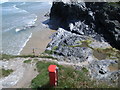
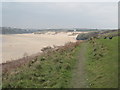
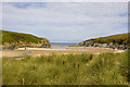
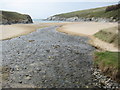
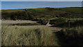
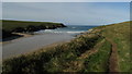
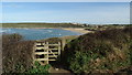
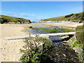
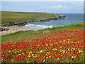
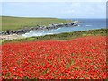

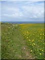
100 photos from this area
Area Information
Key information about the TR8 5SD including its size, population, and administrative classification.
- Area Type
- Postcode
- Area Size
- 24.9 hectares
- Population
- 1728
- Population Density
- 325 people/km²
House Prices in TR8 5SD
9
Properties
£464,875
Average Sold Price
£122,500
Lowest Price
£787,000
Highest Price
Showing 9 properties
| Address | Type | Beds | Baths | Last Sale Price | Last Sale Date | |
|---|---|---|---|---|---|---|
| Clesco, West Pentire Road, Crantock, TR8 5SD | Detached | 4 | 1 | £787,000 | Nov 2023 | |
| Kelsey, West Pentire Road, Crantock, TR8 5SD | Bungalow | 4 | - | £300,000 | Nov 2016 | |
| Broclamont, West Pentire Road, Crantock, TR8 5SD | house | - | - | £650,000 | Dec 2009 | |
| Wave Crests, West Pentire Road, Crantock, TR8 5SD | Detached | - | - | £122,500 | Oct 1996 | |
| Chy Prennglas, Road To West Pentire From Treago Road, West Pentire, Crantock, TR8 5SD | Detached | 5 | 3 | - | - | |
| Seascape, West Pentire Road, Crantock, TR8 5SD | Detached | 4 | 1 | - | - | |
| Bryher, West Pentire Road, Crantock, TR8 5SD | Detached | - | - | - | - | |
| Talland, West Pentire Road, Crantock, TR8 5SD | Detached | - | - | - | - | |
| Trebiddy, West Pentire Road, Crantock, TR8 5SD | Detached | - | - | - | - |
Energy Efficiency in TR8 5SD
Amenities
Schools
| Rank | School | Type | Entry gender | Ages |
|---|
Explore more schools in this area
Go to Schools tabDemographics
Household Size
Two person
most common
Accommodation Type
Houses
most common
Tenure
63
majority
Ethnic Group
White
most common
Religion
N/A
most common
Household Composition
N/A
most common
Age
47
median
Adults (30-64 years)
most common
Household Deprivation
N/A
with no deprivation
NS-SEC
34
in Lower managerial occupations
Explore more demographic insights in this area
Go to Demographics tabPlanning
Planning Constraints
- Flood RiskPremium
- Ramsar Wetland SitesPremium
- Area of Outstanding Natural BeautyPremium
- Protected Nature ReservePremium
- Protected WoodlandPremium