Area Overview for TR8 5SE
Photos of TR8 5SE
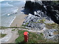
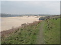
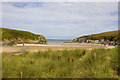
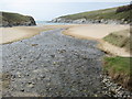
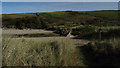
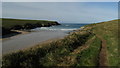
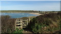
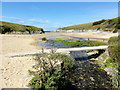
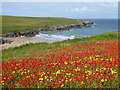
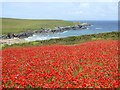

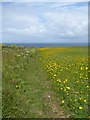
100 photos from this area
Area Information
Key information about the TR8 5SE including its size, population, and administrative classification.
- Area Type
- Postcode
- Area Size
- 1.4 km²
- Population
- 1336
- Population Density
- 96 people/km²
House Prices in TR8 5SE
34
Properties
£511,500
Average Sold Price
£247,500
Lowest Price
£1,225,000
Highest Price
Showing 34 properties
| Address | Type | Beds | Baths | Last Sale Price | Last Sale Date | |
|---|---|---|---|---|---|---|
| West Pentire House, West Pentire Road, Crantock, TR8 5SE | house | - | - | £800,000 | Jan 2022 | |
| 1, GOOSE ROCK APARTMENTS, WEST PENTIRE ROAD, Crantock, TR8 5SE | Flat | - | - | £390,000 | Jun 2021 | |
| SEA VIEW, WEST PENTIRE ROAD, Crantock, TR8 5SE | Detached | - | - | £815,000 | Apr 2021 | |
| Four Acres, West Pentire Road, Crantock, TR8 5SE | house | - | - | £1,225,000 | Feb 2021 | |
| 12, Crantock Bay Apartments, Road To West Pentire From Treago Road, West Pentire, Crantock, TR8 5SE | Flat | 2 | 2 | £650,000 | Dec 2020 | |
| Polly Joke Cottage, West Pentire Road, Crantock, TR8 5SE | Detached | - | - | £268,000 | Mar 2016 | |
| 1, Crantock Bay Apartments, West Pentire Road, Crantock, TR8 5SE | Flat | 4 | - | £535,000 | Nov 2015 | |
| 3, Crantock Bay Apartments, West Pentire Road, Crantock, TR8 5SE | Flat | - | - | £460,000 | Mar 2014 | |
| 13, Crantock Bay Apartments, West Pentire Road, Crantock, TR8 5SE | Flat | - | - | £380,000 | Sep 2013 | |
| 4, Crantock Bay Apartments, West Pentire Road, Crantock, TR8 5SE | Flat | - | - | £420,000 | Sep 2013 |
Page 1 of 4
Energy Efficiency in TR8 5SE
Amenities
Schools
| Rank | School | Type | Entry gender | Ages |
|---|
Explore more schools in this area
Go to Schools tabDemographics
Household Size
Two person
most common
Accommodation Type
Houses
most common
Tenure
82
majority
Ethnic Group
White
most common
Religion
N/A
most common
Household Composition
N/A
most common
Age
47
median
Adults (30-64 years)
most common
Household Deprivation
N/A
with no deprivation
NS-SEC
37
in Lower managerial occupations
Explore more demographic insights in this area
Go to Demographics tabPlanning
Planning Constraints
- Flood RiskPremium
- Ramsar Wetland SitesPremium
- Area of Outstanding Natural BeautyPremium
- Protected Nature ReservePremium
- Protected WoodlandPremium