Area Overview for TR8 5RZ
Photos of TR8 5RZ

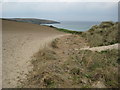
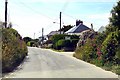
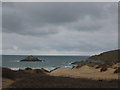
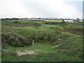

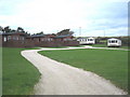
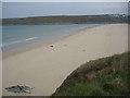
17 photos from this area
Area Information
Key information about the TR8 5RZ including its size, population, and administrative classification.
- Area Type
- Postcode
- Area Size
- 9.5 hectares
- Population
- 1728
- Population Density
- 325 people/km²
House Prices in TR8 5RZ
35
Properties
£418,382
Average Sold Price
£65,000
Lowest Price
£1,100,000
Highest Price
Showing 35 properties
| Address | Type | Beds | Baths | Last Sale Price | Last Sale Date | |
|---|---|---|---|---|---|---|
| Da Nance, West Pentire Road, Crantock, TR8 5RZ | Detached | 4 | - | £630,000 | Oct 2021 | |
| Grey Cottage, West Pentire Road, Crantock, TR8 5RZ | house | - | - | £431,000 | Mar 2021 | |
| Tamarak, West Pentire Road, Crantock, TR8 5RZ | Bungalow | - | - | £300,000 | Nov 2020 | |
| Nenagh, West Pentire Road, Crantock, TR8 5RZ | Detached | 7 | 7 | £1,100,000 | Feb 2020 | |
| Kevardhu, West Pentire Road, Crantock, TR8 5RZ | Bungalow | 2 | 2 | £392,500 | Oct 2019 | |
| Berwyn, West Pentire Road, Crantock, TR8 5RZ | Terraced | 5 | 3 | £475,000 | Aug 2019 | |
| Genista, West Pentire Road, Crantock, TR8 5RZ | Detached | 3 | 2 | £370,000 | Jul 2019 | |
| Zarven, West Pentire Road, Crantock, TR8 5RZ | Detached | 4 | 3 | £500,000 | Sep 2018 | |
| Whitecroft, West Pentire Road, Crantock, TR8 5RZ | Terraced | 4 | 2 | £285,000 | Apr 2018 | |
| Alanna, West Pentire Road, Crantock, TR8 5RZ | Detached | 3 | 3 | £350,000 | Aug 2016 |
Page 1 of 4
Energy Efficiency in TR8 5RZ
Amenities
Schools
| Rank | School | Type | Entry gender | Ages |
|---|
Explore more schools in this area
Go to Schools tabDemographics
Household Size
Two person
most common
Accommodation Type
Houses
most common
Tenure
63
majority
Ethnic Group
White
most common
Religion
N/A
most common
Household Composition
N/A
most common
Age
47
median
Adults (30-64 years)
most common
Household Deprivation
N/A
with no deprivation
NS-SEC
34
in Lower managerial occupations
Explore more demographic insights in this area
Go to Demographics tabPlanning
Planning Constraints
- Flood RiskPremium
- Ramsar Wetland SitesPremium
- Area of Outstanding Natural BeautyPremium
- Protected Nature ReservePremium
- Protected WoodlandPremium