Area Overview for TR26 1SZ
Photos of TR26 1SZ
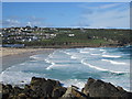
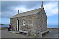
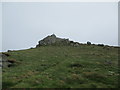
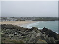
98 photos from this area
Area Information
Key information about the TR26 1SZ including its size, population, and administrative classification.
- Area Type
- Postcode
- Area Size
- 2.0 hectares
- Population
- 1226
- Population Density
- 2683 people/km²
House Prices in TR26 1SZ
22
Properties
£339,386
Average Sold Price
£31,500
Lowest Price
£560,000
Highest Price
Showing 22 properties
| Address | Type | Beds | Baths | Last Sale Price | Last Sale Date | |
|---|---|---|---|---|---|---|
| 15 St Nicholas Court, St Ives, TR26 1SZ | Flat | - | - | £560,000 | Aug 2018 | |
| 39 St Nicholas Court, St Ives, TR26 1SZ | Maisonette | 1 | 1 | £410,000 | Apr 2018 | |
| 16 ST NICHOLAS COURT, St Ives, TR26 1SZ | Flat | 3 | - | £520,000 | Mar 2016 | |
| 41 St Nicholas Court, St Ives, TR26 1SZ | Flat | 1 | - | £270,000 | Aug 2013 | |
| 19 St Nicholas Court, St Ives, TR26 1SZ | Flat | - | - | £250,000 | Jan 2013 | |
| 20 St Nicholas Court, St Ives, TR26 1SZ | Maisonette | - | - | £250,000 | Aug 2011 | |
| 17 St Nicholas Court, St Ives, TR26 1SZ | Flat | - | - | £285,000 | Sep 2009 | |
| 25 St Nicholas Court, St Ives, TR26 1SZ | Flat | - | - | £350,000 | Jul 2008 | |
| 12 St Nicholas Court, St Ives, TR26 1SZ | Flat | - | - | £432,500 | Apr 2007 | |
| 13 St Nicholas Court, St Ives, TR26 1SZ | Flat | - | - | £374,250 | Nov 2004 |
Page 1 of 3
Energy Efficiency in TR26 1SZ
Amenities
Schools
| Rank | School | Type | Entry gender | Ages |
|---|
Explore more schools in this area
Go to Schools tabDemographics
Household Size
One person
most common
Accommodation Type
Houses
most common
Tenure
55
majority
Ethnic Group
White
most common
Religion
N/A
most common
Household Composition
N/A
most common
Age
47
median
Adults (30-64 years)
most common
Household Deprivation
N/A
with no deprivation
NS-SEC
32
in Lower managerial occupations
Explore more demographic insights in this area
Go to Demographics tabPlanning
Planning Constraints
- Flood RiskPremium
- Ramsar Wetland SitesPremium
- Area of Outstanding Natural BeautyPremium
- Protected Nature ReservePremium
- Protected WoodlandPremium