Area Overview for TR26 1NU
Photos of TR26 1NU
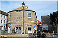
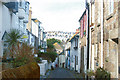
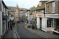
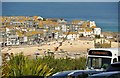
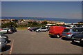
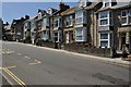
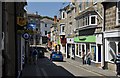
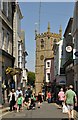
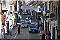
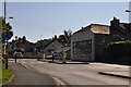
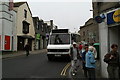
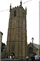
100 photos from this area
Area Information
Key information about the TR26 1NU including its size, population, and administrative classification.
- Area Type
- Postcode
- Area Size
- 1190 m²
- Population
- 1226
- Population Density
- 1030190 people/km²
House Prices in TR26 1NU
12
Properties
£413,930
Average Sold Price
£214,650
Lowest Price
£720,000
Highest Price
Showing 12 properties
| Address | Type | Beds | Baths | Last Sale Price | Last Sale Date | |
|---|---|---|---|---|---|---|
| 6 Burrow Road, St Ives, TR26 1NU | Flat | 2 | - | £720,000 | Jun 2023 | |
| 18 Burrow Road, St Ives, TR26 1NU | house | - | - | £495,000 | Dec 2014 | |
| 4 Burrow Road, St Ives, TR26 1NU | house | - | - | £340,000 | Apr 2008 | |
| 7 Burrow Road, St Ives, TR26 1NU | Terraced | - | - | £300,000 | May 2003 | |
| The Lookout, 15 Burrow Road, St Ives, TR26 1NU | house | - | - | £214,650 | Feb 2002 | |
| 9 Burrow Road, St Ives, TR26 1NU | house | 4 | 3 | - | - | |
| 1A Burrow Road, St Ives, TR26 1NU | Terraced | 1 | 1 | - | - | |
| 1 Burrow Road, St Ives, TR26 1NU | Maisonette | 4 | 3 | - | - | |
| Rostrevor, 14 Burrow Road, St Ives, TR26 1NU | Maisonette | - | - | - | - | |
| 12 Burrow Road, St Ives, TR26 1NU | Terraced | - | - | - | - |
Page 1 of 2
Energy Efficiency in TR26 1NU
Amenities
Schools
| Rank | School | Type | Entry gender | Ages |
|---|
Explore more schools in this area
Go to Schools tabDemographics
Household Size
One person
most common
Accommodation Type
Houses
most common
Tenure
55
majority
Ethnic Group
White
most common
Religion
N/A
most common
Household Composition
N/A
most common
Age
47
median
Adults (30-64 years)
most common
Household Deprivation
N/A
with no deprivation
NS-SEC
32
in Lower managerial occupations
Explore more demographic insights in this area
Go to Demographics tabPlanning
Planning Constraints
- Flood RiskPremium
- Ramsar Wetland SitesPremium
- Area of Outstanding Natural BeautyPremium
- Protected Nature ReservePremium
- Protected WoodlandPremium