Area Overview for TR26 1SY
Photos of TR26 1SY
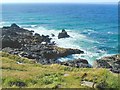
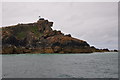
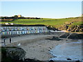
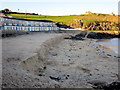
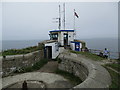
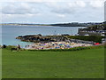
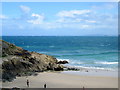
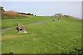
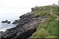
104 photos from this area
Area Information
Key information about the TR26 1SY including its size, population, and administrative classification.
- Area Type
- Postcode
- Area Size
- 4.6 hectares
- Population
- 1226
- Population Density
- 2683 people/km²
House Prices in TR26 1SY
3
Properties
£460,000
Average Sold Price
£460,000
Lowest Price
£460,000
Highest Price
Showing 3 properties
| Address | Type | Beds | Baths | Last Sale Price | Last Sale Date | |
|---|---|---|---|---|---|---|
| Knot Cottage, 2 The Rope Walk, St Ives, TR26 1SY | Terraced | 1 | 1 | £460,000 | Mar 2008 | |
| Ropewalk Studio, 1 The Rope Walk, St Ives, TR26 1SY | endTerrace | 1 | 1 | - | - | |
| Surf School At The Battery, The Island Blockhouse, Island Square, St Ives, TR26 1SY | office_workshop | - | - | - | - |
Energy Efficiency in TR26 1SY
Amenities
Schools
| Rank | School | Type | Entry gender | Ages |
|---|
Explore more schools in this area
Go to Schools tabDemographics
Household Size
One person
most common
Accommodation Type
Houses
most common
Tenure
55
majority
Ethnic Group
White
most common
Religion
N/A
most common
Household Composition
N/A
most common
Age
47
median
Adults (30-64 years)
most common
Household Deprivation
N/A
with no deprivation
NS-SEC
32
in Lower managerial occupations
Explore more demographic insights in this area
Go to Demographics tabPlanning
Planning Constraints
- Flood RiskPremium
- Ramsar Wetland SitesPremium
- Area of Outstanding Natural BeautyPremium
- Protected Nature ReservePremium
- Protected WoodlandPremium