Area Overview for TQ4 6JN
Photos of TQ4 6JN
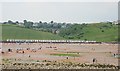
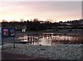
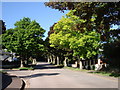
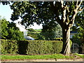
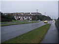
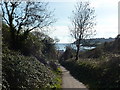
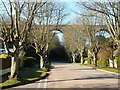
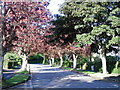
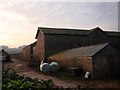

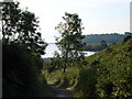
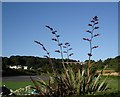
100 photos from this area
Area Information
Key information about the TQ4 6JN including its size, population, and administrative classification.
- Area Type
- Postcode
- Area Size
- 2.1 hectares
- Population
- 1383
- Population Density
- 1011 people/km²
House Prices in TQ4 6JN
29
Properties
£256,402
Average Sold Price
£72,500
Lowest Price
£567,000
Highest Price
Showing 29 properties
| Address | Type | Beds | Baths | Last Sale Price | Last Sale Date | |
|---|---|---|---|---|---|---|
| 30 Broadsands Avenue, Paignton, TQ4 6JN | Bungalow | 4 | 2 | £567,000 | Dec 2024 | |
| 56 Broadsands Avenue, Paignton, TQ4 6JN | Bungalow | 4 | 2 | £378,000 | Feb 2020 | |
| 42 Broadsands Avenue, Paignton, TQ4 6JN | Bungalow | 3 | 2 | £280,000 | Jan 2019 | |
| 54 Broadsands Avenue, Paignton, TQ4 6JN | Bungalow | 2 | 2 | £362,000 | Nov 2018 | |
| 12 Broadsands Avenue, Paignton, TQ4 6JN | Bungalow | 3 | 1 | £375,000 | Jul 2017 | |
| 4 Broadsands Avenue, Paignton, TQ4 6JN | Bungalow | 3 | - | £349,500 | Apr 2017 | |
| 50 Broadsands Avenue, Paignton, TQ4 6JN | Bungalow | 3 | 2 | £328,500 | Mar 2016 | |
| 34 Broadsands Avenue, Paignton, TQ4 6JN | Bungalow | 2 | 1 | £250,000 | Sep 2015 | |
| 36 Broadsands Avenue, Paignton, TQ4 6JN | Bungalow | 3 | - | £315,000 | Oct 2014 | |
| 26 Broadsands Avenue, Paignton, TQ4 6JN | Semi-detached | 2 | - | £235,000 | Sep 2014 |
Page 1 of 3
Energy Efficiency in TQ4 6JN
Amenities
Schools
| Rank | School | Type | Entry gender | Ages |
|---|
Explore more schools in this area
Go to Schools tabDemographics
Household Size
Two person
most common
Accommodation Type
Houses
most common
Tenure
94
majority
Ethnic Group
White
most common
Religion
N/A
most common
Household Composition
N/A
most common
Age
47
median
Elderly (65+ years)
most common
Household Deprivation
N/A
with no deprivation
NS-SEC
40
in Lower managerial occupations
Explore more demographic insights in this area
Go to Demographics tabPlanning
Planning Constraints
- Flood RiskPremium
- Ramsar Wetland SitesPremium
- Area of Outstanding Natural BeautyPremium
- Protected Nature ReservePremium
- Protected WoodlandPremium