Area Overview for TQ4 6JG
Photos of TQ4 6JG
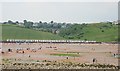
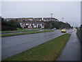
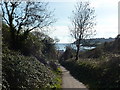
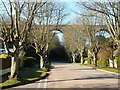
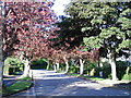
100 photos from this area
Area Information
Key information about the TQ4 6JG including its size, population, and administrative classification.
- Area Type
- Postcode
- Area Size
- 3.6 hectares
- Population
- 1383
- Population Density
- 1011 people/km²
House Prices in TQ4 6JG
33
Properties
£316,095
Average Sold Price
£58,500
Lowest Price
£675,000
Highest Price
Showing 33 properties
| Address | Type | Beds | Baths | Last Sale Price | Last Sale Date | |
|---|---|---|---|---|---|---|
| 25 Broadsands Park Road, Paignton, TQ4 6JG | Bungalow | 3 | 3 | £675,000 | Apr 2023 | |
| 15 Broadsands Park Road, Paignton, TQ4 6JG | Retail | 2 | - | £400,000 | Dec 2021 | |
| 9 Broadsands Park Road, Paignton, TQ4 6JG | house | 3 | 2 | £475,000 | May 2021 | |
| 5 Broadsands Park Road, Paignton, TQ4 6JG | house | 4 | 1 | £540,000 | Apr 2021 | |
| 21 Broadsands Park Road, Paignton, TQ4 6JG | Bungalow | 2 | 1 | £330,000 | Oct 2020 | |
| 17A Broadsands Park Road, Paignton, TQ4 6JG | Flat | 2 | 1 | £277,000 | Sep 2020 | |
| 10 Broadsands Park Road, Paignton, TQ4 6JG | Bungalow | 2 | 2 | £335,000 | Sep 2017 | |
| 13 Broadsands Park Road, Paignton, TQ4 6JG | Bungalow | 2 | 2 | £360,000 | Jul 2017 | |
| 11 Broadsands Park Road, Paignton, TQ4 6JG | Bungalow | 2 | 1 | £280,000 | May 2017 | |
| 20 Broadsands Park Road, Paignton, TQ4 6JG | Bungalow | 3 | 3 | £329,950 | Feb 2017 |
Page 1 of 4
Energy Efficiency in TQ4 6JG
Amenities
Schools
| Rank | School | Type | Entry gender | Ages |
|---|
Explore more schools in this area
Go to Schools tabDemographics
Household Size
Two person
most common
Accommodation Type
Houses
most common
Tenure
94
majority
Ethnic Group
White
most common
Religion
N/A
most common
Household Composition
N/A
most common
Age
47
median
Elderly (65+ years)
most common
Household Deprivation
N/A
with no deprivation
NS-SEC
40
in Lower managerial occupations
Explore more demographic insights in this area
Go to Demographics tabPlanning
Planning Constraints
- Flood RiskPremium
- Ramsar Wetland SitesPremium
- Area of Outstanding Natural BeautyPremium
- Protected Nature ReservePremium
- Protected WoodlandPremium