Area Overview for TQ14 0HA
Photos of TQ14 0HA
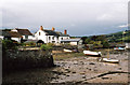
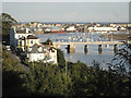
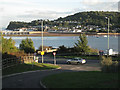
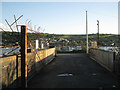
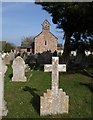
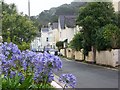
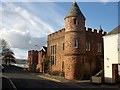
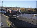
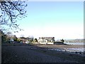
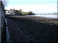
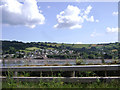
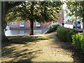
100 photos from this area
Area Information
Key information about the TQ14 0HA including its size, population, and administrative classification.
- Area Type
- Postcode
- Area Size
- 1.3 hectares
- Population
- 1215
- Population Density
- 152 people/km²
House Prices in TQ14 0HA
7
Properties
£497,750
Average Sold Price
£170,000
Lowest Price
£875,000
Highest Price
Showing 7 properties
| Address | Type | Beds | Baths | Last Sale Price | Last Sale Date | |
|---|---|---|---|---|---|---|
| Site Of West Bank, Pound Lane, Shaldon, TQ14 0HA | Detached | 4 | 4 | £875,000 | Apr 2024 | |
| Woodcott, Pound Lane, Shaldon, TQ14 0HA | Bungalow | - | - | £426,000 | Sep 2016 | |
| Little Court, Pound Lane, Shaldon, TQ14 0HA | house | 3 | 2 | £170,000 | Feb 2013 | |
| Omega, Pound Lane, Shaldon, TQ14 0HA | Detached | - | - | £520,000 | Apr 2006 | |
| Homeacre, Pound Lane, Shaldon, TQ14 0HA | Bungalow | 3 | - | - | - | |
| Dacre House, Pound Lane, Shaldon, TQ14 0HA | Terraced | - | - | - | - | |
| Long Orchard, Pound Lane, Shaldon, TQ14 0HA | Detached | - | - | - | - |
Energy Efficiency in TQ14 0HA
Amenities
Schools
| Rank | School | Type | Entry gender | Ages |
|---|
Explore more schools in this area
Go to Schools tabDemographics
Household Size
Two person
most common
Accommodation Type
Houses
most common
Tenure
82
majority
Ethnic Group
White
most common
Religion
N/A
most common
Household Composition
N/A
most common
Age
47
median
Adults (30-64 years)
most common
Household Deprivation
N/A
with no deprivation
NS-SEC
44
in Lower managerial occupations
Explore more demographic insights in this area
Go to Demographics tabPlanning
Planning Constraints
- Flood RiskPremium
- Ramsar Wetland SitesPremium
- Area of Outstanding Natural BeautyPremium
- Protected Nature ReservePremium
- Protected WoodlandPremium