Area Overview for TQ14 0EP
Photos of TQ14 0EP
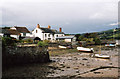


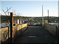
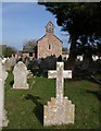
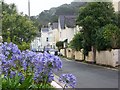


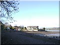


100 photos from this area
Area Information
Key information about the TQ14 0EP including its size, population, and administrative classification.
- Area Type
- Postcode
- Area Size
- 1.1 hectares
- Population
- 1236
- Population Density
- 846 people/km²
House Prices in TQ14 0EP
9
Properties
£703,500
Average Sold Price
£270,000
Lowest Price
£1,170,000
Highest Price
Showing 9 properties
| Address | Type | Beds | Baths | Last Sale Price | Last Sale Date | |
|---|---|---|---|---|---|---|
| Glenside House, 87 Ringmore Road, Shaldon, TQ14 0EP | house | 5 | 5 | £1,170,000 | Feb 2022 | |
| Rosebank, 85 Ringmore Road, Shaldon, TQ14 0EP | house | - | - | £523,000 | Dec 2020 | |
| Templer House, 99 Ringmore Road, Shaldon, TQ14 0EP | Detached | 5 | - | £980,000 | Nov 2020 | |
| 93 Ringmore Road, Shaldon, TQ14 0EP | Bungalow | - | - | £360,500 | Aug 2020 | |
| Brook House, 81 Ringmore Road, Shaldon, TQ14 0EP | Detached | 6 | 4 | £917,500 | Oct 2017 | |
| 91 Ringmore Road, Shaldon, TQ14 0EP | house | 3 | 2 | £270,000 | Apr 2013 | |
| Oakside, Ringmore Road, Shaldon, TQ14 0EP | Detached | 3 | 2 | - | - | |
| 97 Ringmore Road, Shaldon, TQ14 0EP | Land | 1 | - | - | - | |
| Northwing, Rosebank, 85 Ringmore Road, Shaldon, TQ14 0EP | Terraced | - | - | - | - |
Energy Efficiency in TQ14 0EP
Amenities
Schools
| Rank | School | Type | Entry gender | Ages |
|---|
Explore more schools in this area
Go to Schools tabDemographics
Household Size
Two person
most common
Accommodation Type
Houses
most common
Tenure
79
majority
Ethnic Group
White
most common
Religion
N/A
most common
Household Composition
N/A
most common
Age
47
median
Elderly (65+ years)
most common
Household Deprivation
N/A
with no deprivation
NS-SEC
42
in Lower managerial occupations
Explore more demographic insights in this area
Go to Demographics tabPlanning
Planning Constraints
- Flood RiskPremium
- Ramsar Wetland SitesPremium
- Area of Outstanding Natural BeautyPremium
- Protected Nature ReservePremium
- Protected WoodlandPremium