Area Overview for TA7 8LF
Photos of TA7 8LF
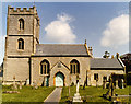
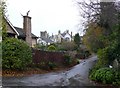

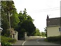
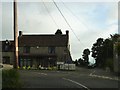
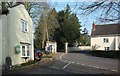


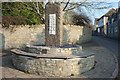
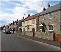

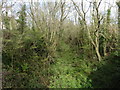
59 photos from this area
Area Information
Key information about the TA7 8LF including its size, population, and administrative classification.
- Area Type
- Postcode
- Area Size
- 8.9 hectares
- Population
- 1314
- Population Density
- 134 people/km²
House Prices in TA7 8LF
25
Properties
£237,500
Average Sold Price
£70,000
Lowest Price
£750,000
Highest Price
Showing 25 properties
| Address | Type | Beds | Baths | Last Sale Price | Last Sale Date | |
|---|---|---|---|---|---|---|
| Brentfield, Brent Road, Cossington, Bridgwater, TA7 8LF | house | - | - | £750,000 | Apr 2021 | |
| Rhiwbina, Brent Road, Cossington, Bridgwater, TA7 8LF | Bungalow | - | - | £395,000 | Oct 2020 | |
| 1 Brent Road, Cossington, Bridgwater, TA7 8LF | house | - | - | £253,000 | Feb 2020 | |
| Ferndale, Brent Road, Cossington, Bridgwater, TA7 8LF | Bungalow | 3 | 1 | £360,000 | Aug 2019 | |
| 7 Brent Road, Cossington, Bridgwater, TA7 8LF | Semi-detached | 3 | - | £235,000 | Feb 2017 | |
| 20 Brent Road, Cossington, Bridgwater, TA7 8LF | Semi-detached | - | - | £76,000 | Aug 1998 | |
| Bourne Dene, Brent Road, Cossington, Bridgwater, TA7 8LF | Bungalow | - | - | £85,000 | Nov 1997 | |
| Cartref, Brent Road, Cossington, Bridgwater, TA7 8LF | Detached | - | - | £80,000 | Mar 1997 | |
| 3 Brent Road, Cossington, Bridgwater, TA7 8LF | Semi-detached | - | - | £71,000 | Feb 1997 | |
| Woodside, Brent Road, Cossington, Bridgwater, TA7 8LF | Detached | - | - | £70,000 | Dec 1995 |
Page 1 of 3
Energy Efficiency in TA7 8LF
Amenities
Schools
| Rank | School | Type | Entry gender | Ages |
|---|
Explore more schools in this area
Go to Schools tabDemographics
Household Size
Two person
most common
Accommodation Type
Houses
most common
Tenure
83
majority
Ethnic Group
White
most common
Religion
N/A
most common
Household Composition
N/A
most common
Age
47
median
Adults (30-64 years)
most common
Household Deprivation
N/A
with no deprivation
NS-SEC
40
in Lower managerial occupations
Explore more demographic insights in this area
Go to Demographics tabPlanning
Planning Constraints
- Flood RiskPremium
- Ramsar Wetland SitesPremium
- Area of Outstanding Natural BeautyPremium
- Protected Nature ReservePremium
- Protected WoodlandPremium