Area Overview for TA7 8LD
Photos of TA7 8LD

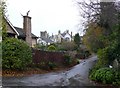

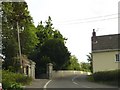
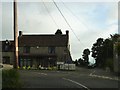
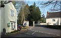
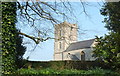

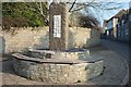
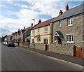

59 photos from this area
Area Information
Key information about the TA7 8LD including its size, population, and administrative classification.
- Area Type
- Postcode
- Area Size
- 8829 m²
- Population
- 1314
- Population Density
- 134 people/km²
House Prices in TA7 8LD
14
Properties
£177,291
Average Sold Price
£79,250
Lowest Price
£315,000
Highest Price
Showing 14 properties
| Address | Type | Beds | Baths | Last Sale Price | Last Sale Date | |
|---|---|---|---|---|---|---|
| 1 Park Crescent, Cossington, Bridgwater, TA7 8LD | house | - | - | £315,000 | Oct 2021 | |
| 17 Park Crescent, Cossington, Bridgwater, TA7 8LD | Bungalow | - | - | £261,000 | Jul 2019 | |
| 13 Park Crescent, Cossington, Bridgwater, TA7 8LD | Bungalow | - | - | £210,000 | Nov 2018 | |
| 2 Park Crescent, Cossington, Bridgwater, TA7 8LD | Bungalow | 2 | - | £209,000 | Jun 2014 | |
| 9 Park Crescent, Cossington, Bridgwater, TA7 8LD | Bungalow | 2 | - | £167,000 | Oct 2012 | |
| 5 Park Crescent, Cossington, Bridgwater, TA7 8LD | Bungalow | - | - | £155,000 | Jun 2010 | |
| 10 Park Crescent, Cossington, Bridgwater, TA7 8LD | Semi-detached | - | - | £164,950 | Nov 2006 | |
| 8 Park Crescent, Cossington, Bridgwater, TA7 8LD | Semi-detached | 2 | 1 | £148,000 | Oct 2006 | |
| 4 Park Crescent, Cossington, Bridgwater, TA7 8LD | Semi-detached | - | - | £146,000 | Aug 2003 | |
| 11 Park Crescent, Cossington, Bridgwater, TA7 8LD | Semi-detached | - | - | £79,250 | Jul 2001 |
Page 1 of 2
Energy Efficiency in TA7 8LD
Amenities
Schools
| Rank | School | Type | Entry gender | Ages |
|---|
Explore more schools in this area
Go to Schools tabDemographics
Household Size
Two person
most common
Accommodation Type
Houses
most common
Tenure
83
majority
Ethnic Group
White
most common
Religion
N/A
most common
Household Composition
N/A
most common
Age
47
median
Adults (30-64 years)
most common
Household Deprivation
N/A
with no deprivation
NS-SEC
40
in Lower managerial occupations
Explore more demographic insights in this area
Go to Demographics tabPlanning
Planning Constraints
- Flood RiskPremium
- Ramsar Wetland SitesPremium
- Area of Outstanding Natural BeautyPremium
- Protected Nature ReservePremium
- Protected WoodlandPremium