Area Overview for TA7 8JR
Photos of TA7 8JR


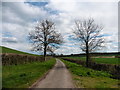


17 photos from this area
Area Information
Key information about the TA7 8JR including its size, population, and administrative classification.
- Area Type
- Postcode
- Area Size
- 44.8 hectares
- Population
- 1314
- Population Density
- 134 people/km²
House Prices in TA7 8JR
23
Properties
£263,125
Average Sold Price
£50,000
Lowest Price
£535,000
Highest Price
Showing 23 properties
| Address | Type | Beds | Baths | Last Sale Price | Last Sale Date | |
|---|---|---|---|---|---|---|
| Old Post Office, Manor Road, Cossington, Bridgwater, TA7 8JR | Detached | 3 | 1 | £445,000 | Mar 2025 | |
| The Haven, Manor Road, Cossington, Bridgwater, TA7 8JR | Detached | 3 | 1 | £327,500 | Jan 2021 | |
| Chestnut Cottage, Manor Road, Cossington, Bridgwater, TA7 8JR | Detached | 3 | 2 | £325,000 | Mar 2019 | |
| Manor Barn, St Marys Close, Cossington, Bridgwater, TA7 8JR | house | 4 | - | £535,000 | Nov 2018 | |
| 4, Manor House, Manor Road, Cossington, Bridgwater, TA7 8JR | Flat | - | - | £177,000 | Jul 2014 | |
| 3, Manor House, Manor Road, Cossington, Bridgwater, TA7 8JR | Bungalow | - | - | £135,000 | Apr 2014 | |
| 2, Manor House, Manor Road, Cossington, Bridgwater, TA7 8JR | Flat | - | - | £50,000 | Jun 2009 | |
| 9 Manor Road, Cossington, Bridgwater, TA7 8JR | Semi-detached | 6 | - | £275,000 | Dec 2004 | |
| Hillview, Manor Road, Cossington, Bridgwater, TA7 8JR | Detached | 4 | 2 | £390,000 | Nov 2004 | |
| West View, Manor Road, Cossington, Bridgwater, TA7 8JR | Detached | - | - | £166,000 | Jun 2002 |
Page 1 of 3
Energy Efficiency in TA7 8JR
Amenities
Schools
| Rank | School | Type | Entry gender | Ages |
|---|
Explore more schools in this area
Go to Schools tabDemographics
Household Size
Two person
most common
Accommodation Type
Houses
most common
Tenure
83
majority
Ethnic Group
White
most common
Religion
N/A
most common
Household Composition
N/A
most common
Age
47
median
Adults (30-64 years)
most common
Household Deprivation
N/A
with no deprivation
NS-SEC
40
in Lower managerial occupations
Explore more demographic insights in this area
Go to Demographics tabPlanning
Planning Constraints
- Flood RiskPremium
- Ramsar Wetland SitesPremium
- Area of Outstanding Natural BeautyPremium
- Protected Nature ReservePremium
- Protected WoodlandPremium