Area Overview for TA6 4BU
Photos of TA6 4BU

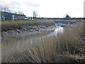
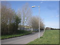

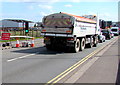

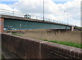
40 photos from this area
Area Information
Key information about the TA6 4BU including its size, population, and administrative classification.
- Area Type
- Postcode
- Area Size
- 9.2 hectares
- Population
- 1725
- Population Density
- 1521 people/km²
House Prices in TA6 4BU
29
Properties
£178,853
Average Sold Price
£40,000
Lowest Price
£375,000
Highest Price
Showing 29 properties
| Address | Type | Beds | Baths | Last Sale Price | Last Sale Date | |
|---|---|---|---|---|---|---|
| 338 Bristol Road, Bridgwater, TA6 4BU | Semi-detached | 3 | - | £195,000 | Jan 2025 | |
| The Annexe, 344 Bristol Road, Bridgwater, TA6 4BU | Bungalow | 3 | - | £350,000 | Oct 2020 | |
| 380 Bristol Road, Bridgwater, TA6 4BU | Semi-detached | 3 | - | £220,000 | May 2019 | |
| 332 Bristol Road, Bridgwater, TA6 4BU | house | 3 | - | £182,000 | Dec 2018 | |
| 358 Bristol Road, Bridgwater, TA6 4BU | Bungalow | 3 | - | £375,000 | Oct 2018 | |
| 362 Bristol Road, Bridgwater, TA6 4BU | Semi-detached | 3 | - | £195,000 | Dec 2017 | |
| 340 Bristol Road, Bridgwater, TA6 4BU | house | - | - | £161,000 | Oct 2016 | |
| 382 Bristol Road, Bridgwater, TA6 4BU | Semi-detached | 3 | - | £124,500 | Sep 2013 | |
| 330 Bristol Road, Bridgwater, TA6 4BU | Bungalow | 2 | 1 | £120,000 | Jun 2013 | |
| 384 Bristol Road, Bridgwater, TA6 4BU | house | 3 | - | £141,000 | Nov 2011 |
Page 1 of 3
Energy Efficiency in TA6 4BU
Amenities
Schools
| Rank | School | Type | Entry gender | Ages |
|---|
Explore more schools in this area
Go to Schools tabDemographics
Household Size
Family (3-5 people)
most common
Accommodation Type
Houses
most common
Tenure
61
majority
Ethnic Group
White
most common
Religion
N/A
most common
Household Composition
N/A
most common
Age
47
median
Adults (30-64 years)
most common
Household Deprivation
N/A
with no deprivation
NS-SEC
16
in Lower managerial occupations
Explore more demographic insights in this area
Go to Demographics tabPlanning
Planning Constraints
- Flood RiskPremium
- Ramsar Wetland SitesPremium
- Area of Outstanding Natural BeautyPremium
- Protected Nature ReservePremium
- Protected WoodlandPremium