Area Overview for TA6 4YX
Photos of TA6 4YX
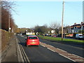

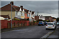
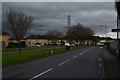
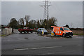
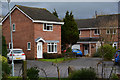


31 photos from this area
Area Information
Key information about the TA6 4YX including its size, population, and administrative classification.
- Area Type
- Postcode
- Area Size
- 1.3 hectares
- Population
- 1725
- Population Density
- 1521 people/km²
House Prices in TA6 4YX
27
Properties
£257,638
Average Sold Price
£235,600
Lowest Price
£290,000
Highest Price
Showing 27 properties
| Address | Type | Beds | Baths | Last Sale Price | Last Sale Date | |
|---|---|---|---|---|---|---|
| 2 Garnet Road, Bridgwater, TA6 4YX | house | - | - | £252,000 | Jun 2022 | |
| 6 Garnet Road, Bridgwater, TA6 4YX | Detached | 4 | 2 | £290,000 | Jun 2022 | |
| 4 Garnet Road, Bridgwater, TA6 4YX | house | - | - | £290,000 | Jun 2022 | |
| 3 Garnet Road, Bridgwater, TA6 4YX | house | - | - | £263,000 | Apr 2022 | |
| 1 Garnet Road, Bridgwater, TA6 4YX | Semi-detached | 3 | 2 | £248,000 | Apr 2022 | |
| 8 Garnet Road, Bridgwater, TA6 4YX | house | - | - | £265,000 | Mar 2022 | |
| 10 Garnet Road, Bridgwater, TA6 4YX | house | - | - | £260,000 | Mar 2022 | |
| 12 Garnet Road, Bridgwater, TA6 4YX | house | - | - | £272,000 | Mar 2022 | |
| 14 Garnet Road, Bridgwater, TA6 4YX | house | - | - | £270,000 | Mar 2022 | |
| 24 Garnet Road, Bridgwater, TA6 4YX | Semi-detached | 3 | 3 | £244,000 | Feb 2022 |
Page 1 of 3
Energy Efficiency in TA6 4YX
Amenities
Schools
| Rank | School | Type | Entry gender | Ages |
|---|
Explore more schools in this area
Go to Schools tabDemographics
Household Size
Family (3-5 people)
most common
Accommodation Type
Houses
most common
Tenure
61
majority
Ethnic Group
White
most common
Religion
N/A
most common
Household Composition
N/A
most common
Age
47
median
Adults (30-64 years)
most common
Household Deprivation
N/A
with no deprivation
NS-SEC
16
in Lower managerial occupations
Explore more demographic insights in this area
Go to Demographics tabPlanning
Planning Constraints
- Flood RiskPremium
- Ramsar Wetland SitesPremium
- Area of Outstanding Natural BeautyPremium
- Protected Nature ReservePremium
- Protected WoodlandPremium