Area Overview for TA6 4BJ
Photos of TA6 4BJ
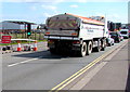
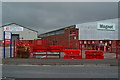
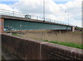
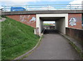
40 photos from this area
Area Information
Key information about the TA6 4BJ including its size, population, and administrative classification.
- Area Type
- Postcode
- Area Size
- 8.8 hectares
- Population
- 1486
- Population Density
- 134 people/km²
House Prices in TA6 4BJ
13
Properties
£197,389
Average Sold Price
£72,500
Lowest Price
£315,000
Highest Price
Showing 13 properties
| Address | Type | Beds | Baths | Last Sale Price | Last Sale Date | |
|---|---|---|---|---|---|---|
| 219 Bristol Road, Bridgwater, TA6 4BJ | house | - | - | £265,000 | Dec 2022 | |
| 199 Bristol Road, Bridgwater, TA6 4BJ | Detached | 4 | 1 | £315,000 | Oct 2022 | |
| 203 Bristol Road, Bridgwater, TA6 4BJ | Detached | 3 | 2 | £215,000 | Jun 2017 | |
| 221 Bristol Road, Bridgwater, TA6 4BJ | house | 3 | - | £187,000 | Dec 2016 | |
| 223 Bristol Road, Bridgwater, TA6 4BJ | Semi-detached | 5 | - | £225,000 | Oct 2014 | |
| 213 Bristol Road, Bridgwater, TA6 4BJ | Semi-detached | 3 | - | £157,000 | Sep 2014 | |
| 201 Bristol Road, Bridgwater, TA6 4BJ | house | 4 | - | £179,000 | Jul 2012 | |
| 215 Bristol Road, Bridgwater, TA6 4BJ | Semi-detached | - | - | £161,000 | Jan 2008 | |
| 197 Bristol Road, Bridgwater, TA6 4BJ | house | - | - | £72,500 | Dec 1997 | |
| 211 Bristol Road, Bridgwater, TA6 4BJ | Detached | 3 | 2 | - | - |
Page 1 of 2
Energy Efficiency in TA6 4BJ
Amenities
Schools
| Rank | School | Type | Entry gender | Ages |
|---|
Explore more schools in this area
Go to Schools tabDemographics
Household Size
Two person
most common
Accommodation Type
Houses
most common
Tenure
83
majority
Ethnic Group
White
most common
Religion
N/A
most common
Household Composition
N/A
most common
Age
47
median
Adults (30-64 years)
most common
Household Deprivation
N/A
with no deprivation
NS-SEC
36
in Lower managerial occupations
Explore more demographic insights in this area
Go to Demographics tabPlanning
Planning Constraints
- Flood RiskPremium
- Ramsar Wetland SitesPremium
- Area of Outstanding Natural BeautyPremium
- Protected Nature ReservePremium
- Protected WoodlandPremium