Area Overview for TA3 5DE
Photos of TA3 5DE

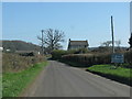
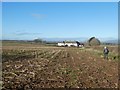
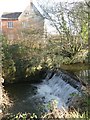
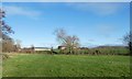


13 photos from this area
Area Information
Key information about the TA3 5DE including its size, population, and administrative classification.
- Area Type
- Postcode
- Area Size
- 65.7 hectares
- Population
- 2245
- Population Density
- 46 people/km²
House Prices in TA3 5DE
13
Properties
£352,200
Average Sold Price
£23,700
Lowest Price
£617,500
Highest Price
Showing 13 properties
| Address | Type | Beds | Baths | Last Sale Price | Last Sale Date | |
|---|---|---|---|---|---|---|
| The Oaks, Stoke Road, Stoke St Mary, Taunton, TA3 5DE | Detached | 4 | 3 | £565,000 | May 2025 | |
| Rose Cottage, Stoke Road, Stoke St Mary, Taunton, TA3 5DE | house | - | - | £600,000 | Jan 2021 | |
| Cherry Grove, Stoke Road, Stoke St Mary, Taunton, TA3 5DE | house | - | - | £617,500 | Mar 2019 | |
| Mount Pleasant, Stoke Road, Stoke St Mary, Taunton, TA3 5DE | Detached | 4 | 3 | £23,700 | Jul 2018 | |
| Appledore, Stoke Road, Stoke St Mary, Taunton, TA3 5DE | Detached | - | - | £242,000 | May 2008 | |
| The Police House, Stoke Road, Stoke St Mary, Taunton, TA3 5DE | Detached | 4 | 1 | £65,000 | Jan 1995 | |
| Higher Broughton Farm, Stoke Road, Stoke St Mary, Taunton, TA3 5DE | house | - | - | - | - | |
| Stoke Farm, Stoke Road, Stoke St Mary, Taunton, TA3 5DE | house | - | - | - | - | |
| Little Orchard, Stoke Road, Stoke St Mary, Taunton, TA3 5DE | Detached | - | - | - | - | |
| Meadow Cottage, Stoke Road, Stoke St Mary, Taunton, TA3 5DE | Semi-detached | 3 | - | - | - |
Page 1 of 2
Energy Efficiency in TA3 5DE
Amenities
Schools
| Rank | School | Type | Entry gender | Ages |
|---|
Explore more schools in this area
Go to Schools tabDemographics
Household Size
Two person
most common
Accommodation Type
Houses
most common
Tenure
78
majority
Ethnic Group
White
most common
Religion
N/A
most common
Household Composition
N/A
most common
Age
47
median
Adults (30-64 years)
most common
Household Deprivation
N/A
with no deprivation
NS-SEC
41
in Lower managerial occupations
Explore more demographic insights in this area
Go to Demographics tabPlanning
Planning Constraints
- Flood RiskPremium
- Ramsar Wetland SitesPremium
- Area of Outstanding Natural BeautyPremium
- Protected Nature ReservePremium
- Protected WoodlandPremium