Area Overview for TA3 5BY
Photos of TA3 5BY
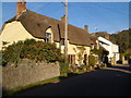


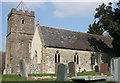

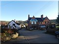

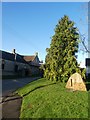
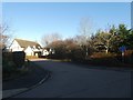
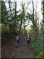
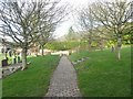

48 photos from this area
Area Information
Key information about the TA3 5BY including its size, population, and administrative classification.
- Area Type
- Postcode
- Area Size
- 5.5 hectares
- Population
- 2245
- Population Density
- 46 people/km²
House Prices in TA3 5BY
27
Properties
£293,038
Average Sold Price
£112,000
Lowest Price
£615,000
Highest Price
Showing 27 properties
| Address | Type | Beds | Baths | Last Sale Price | Last Sale Date | |
|---|---|---|---|---|---|---|
| The Cottage, Stoke Road, Stoke St Mary, Taunton, TA3 5BY | house | - | - | £380,000 | Apr 2023 | |
| Smithy Cottage, Stoke Road, Stoke St Mary, Taunton, TA3 5BY | Terraced | 2 | 1 | £327,500 | Jun 2021 | |
| Court Croft, Stoke Road, Stoke St Mary, Taunton, TA3 5BY | Detached | 3 | 1 | £350,000 | Mar 2020 | |
| Coseley, Stoke Road, Stoke St Mary, Taunton, TA3 5BY | Bungalow | - | - | £345,000 | Mar 2019 | |
| 287 Stoke Road, Stoke St Mary, Taunton, TA3 5BY | Semi-detached | 3 | 1 | £240,000 | Jan 2018 | |
| Fyrse Cottage, Stoke Road, Stoke St Mary, Taunton, TA3 5BY | Detached | - | - | £615,000 | Sep 2016 | |
| Mayfield, Stoke Road, Stoke St Mary, Taunton, TA3 5BY | Semi-detached | 3 | 2 | £260,000 | Apr 2016 | |
| Hardwell Cottage, Stoke Road, Stoke St Mary, Taunton, TA3 5BY | house | - | - | £310,000 | Mar 2016 | |
| 288 Stoke Road, Stoke St Mary, Taunton, TA3 5BY | Semi-detached | 3 | 1 | £210,000 | Sep 2014 | |
| Vine Cottage, Stoke Road, Stoke St Mary, Taunton, TA3 5BY | house | - | - | £200,000 | May 2009 |
Page 1 of 3
Energy Efficiency in TA3 5BY
Amenities
Schools
| Rank | School | Type | Entry gender | Ages |
|---|
Explore more schools in this area
Go to Schools tabDemographics
Household Size
Two person
most common
Accommodation Type
Houses
most common
Tenure
78
majority
Ethnic Group
White
most common
Religion
N/A
most common
Household Composition
N/A
most common
Age
47
median
Adults (30-64 years)
most common
Household Deprivation
N/A
with no deprivation
NS-SEC
41
in Lower managerial occupations
Explore more demographic insights in this area
Go to Demographics tabPlanning
Planning Constraints
- Flood RiskPremium
- Ramsar Wetland SitesPremium
- Area of Outstanding Natural BeautyPremium
- Protected Nature ReservePremium
- Protected WoodlandPremium