Area Overview for TA3 5DG
Photos of TA3 5DG
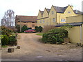
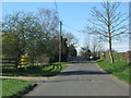

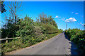


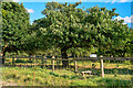
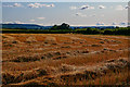


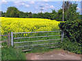

21 photos from this area
Area Information
Key information about the TA3 5DG including its size, population, and administrative classification.
- Area Type
- Postcode
- Area Size
- 60.9 hectares
- Population
- 2245
- Population Density
- 46 people/km²
House Prices in TA3 5DG
7
Properties
£307,168
Average Sold Price
£115,000
Lowest Price
£585,840
Highest Price
Showing 7 properties
| Address | Type | Beds | Baths | Last Sale Price | Last Sale Date | |
|---|---|---|---|---|---|---|
| Stoke Orchard, Stoke Road, Stoke St Mary, Taunton, TA3 5DG | house | 6 | - | £585,840 | Oct 2014 | |
| Mountain Ash, Stoke Lane, Stoke St Mary, Taunton, TA3 5DG | Bungalow | - | - | £345,000 | Aug 2011 | |
| Highfields, Stoke Road, Stoke St Mary, Taunton, TA3 5DG | Detached | - | - | £350,000 | Mar 2007 | |
| Weavers, Stoke Lane, Stoke St Mary, Taunton, TA3 5DG | Bungalow | - | - | £140,000 | Feb 2001 | |
| Elmar, Stoke Lane, Stoke St Mary, Taunton, TA3 5DG | Detached | - | - | £115,000 | Feb 1997 | |
| Inglenook, Stoke Lane, Stoke St Mary, Taunton, TA3 5DG | Detached | - | - | - | - | |
| The Annexe, Weavers, Stoke Lane, Stoke St Mary, Taunton, TA3 5DG | Flat | - | - | - | - |
Energy Efficiency in TA3 5DG
Amenities
Schools
| Rank | School | Type | Entry gender | Ages |
|---|
Explore more schools in this area
Go to Schools tabDemographics
Household Size
Two person
most common
Accommodation Type
Houses
most common
Tenure
78
majority
Ethnic Group
White
most common
Religion
N/A
most common
Household Composition
N/A
most common
Age
47
median
Adults (30-64 years)
most common
Household Deprivation
N/A
with no deprivation
NS-SEC
41
in Lower managerial occupations
Explore more demographic insights in this area
Go to Demographics tabPlanning
Planning Constraints
- Flood RiskPremium
- Ramsar Wetland SitesPremium
- Area of Outstanding Natural BeautyPremium
- Protected Nature ReservePremium
- Protected WoodlandPremium