Area Overview for TA2 7QS
Photos of TA2 7QS
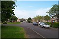


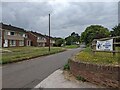
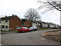
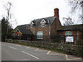
20 photos from this area
Area Information
Key information about the TA2 7QS including its size, population, and administrative classification.
- Area Type
- Postcode
- Area Size
- 3.9 hectares
- Population
- 1465
- Population Density
- 80 people/km²
House Prices in TA2 7QS
27
Properties
£160,250
Average Sold Price
£38,000
Lowest Price
£233,000
Highest Price
Showing 27 properties
| Address | Type | Beds | Baths | Last Sale Price | Last Sale Date | |
|---|---|---|---|---|---|---|
| 394 Cheddon Road, Taunton, TA2 7QS | Terraced | 3 | - | £205,000 | Aug 2024 | |
| 382 Cheddon Road, Taunton, TA2 7QS | house | - | - | £233,000 | Mar 2022 | |
| 422 Cheddon Road, Taunton, TA2 7QS | house | - | - | £177,500 | Mar 2021 | |
| 388 Cheddon Road, Taunton, TA2 7QS | house | - | - | £172,500 | Aug 2019 | |
| 410 Cheddon Road, Taunton, TA2 7QS | Terraced | 3 | - | £168,000 | May 2019 | |
| 418 Cheddon Road, Taunton, TA2 7QS | house | - | - | £150,000 | May 2019 | |
| 380 Cheddon Road, Taunton, TA2 7QS | house | - | - | £138,000 | May 2010 | |
| 420 Cheddon Road, Taunton, TA2 7QS | house | - | - | £38,000 | Oct 1998 | |
| 384 Cheddon Road, Taunton, TA2 7QS | house | - | - | - | - | |
| 414 Cheddon Road, Taunton, TA2 7QS | house | - | - | - | - |
Page 1 of 3
Energy Efficiency in TA2 7QS
Amenities
Schools
| Rank | School | Type | Entry gender | Ages |
|---|
Explore more schools in this area
Go to Schools tabDemographics
Household Size
Two person
most common
Accommodation Type
Houses
most common
Tenure
72
majority
Ethnic Group
White
most common
Religion
N/A
most common
Household Composition
N/A
most common
Age
47
median
Adults (30-64 years)
most common
Household Deprivation
N/A
with no deprivation
NS-SEC
41
in Lower managerial occupations
Explore more demographic insights in this area
Go to Demographics tabPlanning
Planning Constraints
- Flood RiskPremium
- Ramsar Wetland SitesPremium
- Area of Outstanding Natural BeautyPremium
- Protected Nature ReservePremium
- Protected WoodlandPremium