Area Overview for TA2 7RR
Photos of TA2 7RR
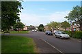


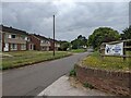
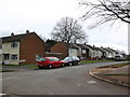
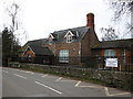
20 photos from this area
Area Information
Key information about the TA2 7RR including its size, population, and administrative classification.
- Area Type
- Postcode
- Area Size
- 6404 m²
- Population
- 1359
- Population Density
- 6163 people/km²
House Prices in TA2 7RR
20
Properties
£149,531
Average Sold Price
£47,750
Lowest Price
£250,000
Highest Price
Showing 20 properties
| Address | Type | Beds | Baths | Last Sale Price | Last Sale Date | |
|---|---|---|---|---|---|---|
| 18 Ladymead Road, Taunton, TA2 7RR | house | 4 | 1 | £250,000 | Dec 2022 | |
| 2 Ladymead Road, Taunton, TA2 7RR | house | - | - | £225,000 | Dec 2022 | |
| 16 Ladymead Road, Taunton, TA2 7RR | Terraced | 3 | 1 | £168,000 | Nov 2018 | |
| 20 Ladymead Road, Taunton, TA2 7RR | house | - | - | £127,500 | May 2017 | |
| 38 Ladymead Road, Taunton, TA2 7RR | house | - | - | £125,000 | Apr 2010 | |
| 14 Ladymead Road, Taunton, TA2 7RR | Terraced | - | - | £120,000 | Jul 2009 | |
| 4 Ladymead Road, Taunton, TA2 7RR | Terraced | 3 | 1 | £133,000 | Jun 2006 | |
| 36 Ladymead Road, Taunton, TA2 7RR | house | - | - | £47,750 | Feb 1998 | |
| 6 Ladymead Road, Taunton, TA2 7RR | Terraced | - | - | - | - | |
| 40 Ladymead Road, Taunton, TA2 7RR | house | - | - | - | - |
Page 1 of 2
Energy Efficiency in TA2 7RR
Amenities
Schools
| Rank | School | Type | Entry gender | Ages |
|---|
Explore more schools in this area
Go to Schools tabDemographics
Household Size
One person
most common
Accommodation Type
Houses
most common
Tenure
41
majority
Ethnic Group
White
most common
Religion
N/A
most common
Household Composition
N/A
most common
Age
47
median
Adults (30-64 years)
most common
Household Deprivation
N/A
with no deprivation
NS-SEC
18
in Lower managerial occupations
Explore more demographic insights in this area
Go to Demographics tabPlanning
Planning Constraints
- Flood RiskPremium
- Ramsar Wetland SitesPremium
- Area of Outstanding Natural BeautyPremium
- Protected Nature ReservePremium
- Protected WoodlandPremium