Area Overview for TA2 7RW
Photos of TA2 7RW
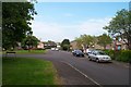
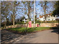
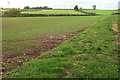
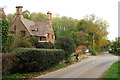
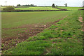
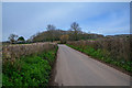
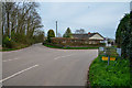
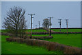

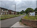
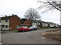
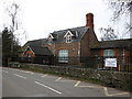
20 photos from this area
Area Information
Key information about the TA2 7RW including its size, population, and administrative classification.
- Area Type
- Postcode
- Area Size
- 5672 m²
- Population
- 1332
- Population Density
- 3902 people/km²
House Prices in TA2 7RW
21
Properties
£115,039
Average Sold Price
£29,500
Lowest Price
£217,500
Highest Price
Showing 21 properties
| Address | Type | Beds | Baths | Last Sale Price | Last Sale Date | |
|---|---|---|---|---|---|---|
| 141 Dorchester Road, Taunton, TA2 7RW | house | 3 | 1 | £217,500 | Aug 2022 | |
| 104 Dorchester Road, Taunton, TA2 7RW | house | - | - | £177,500 | Jan 2022 | |
| 143 Dorchester Road, Taunton, TA2 7RW | Semi-detached | 3 | - | £190,000 | Jan 2019 | |
| 127 Dorchester Road, Taunton, TA2 7RW | house | - | - | £119,950 | Nov 2013 | |
| 123 Dorchester Road, Taunton, TA2 7RW | Semi-detached | - | - | £152,000 | May 2007 | |
| 131 Dorchester Road, Taunton, TA2 7RW | Terraced | - | - | £64,950 | May 2000 | |
| 133 Dorchester Road, Taunton, TA2 7RW | Terraced | - | - | £43,950 | Sep 1997 | |
| 102 Dorchester Road, Taunton, TA2 7RW | Terraced | - | - | £29,500 | Mar 1996 | |
| 125 Dorchester Road, Taunton, TA2 7RW | Terraced | - | - | £40,000 | Nov 1995 | |
| 110 Dorchester Road, Taunton, TA2 7RW | house | - | - | - | - |
Page 1 of 3
Energy Efficiency in TA2 7RW
Amenities
Schools
| Rank | School | Type | Entry gender | Ages |
|---|
Explore more schools in this area
Go to Schools tabDemographics
Household Size
Two person
most common
Accommodation Type
Houses
most common
Tenure
69
majority
Ethnic Group
White
most common
Religion
N/A
most common
Household Composition
N/A
most common
Age
47
median
Adults (30-64 years)
most common
Household Deprivation
N/A
with no deprivation
NS-SEC
26
in Lower managerial occupations
Explore more demographic insights in this area
Go to Demographics tabPlanning
Planning Constraints
- Flood RiskPremium
- Ramsar Wetland SitesPremium
- Area of Outstanding Natural BeautyPremium
- Protected Nature ReservePremium
- Protected WoodlandPremium