Area Overview for SP5 1SJ
Photos of SP5 1SJ
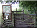


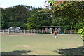
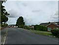
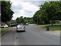
6 photos from this area
Area Information
Key information about the SP5 1SJ including its size, population, and administrative classification.
- Area Type
- Postcode
- Area Size
- 6.2 hectares
- Population
- 1943
- Population Density
- 62 people/km²
House Prices in SP5 1SJ
12
Properties
£436,458
Average Sold Price
£170,000
Lowest Price
£850,000
Highest Price
Showing 12 properties
| Address | Type | Beds | Baths | Last Sale Price | Last Sale Date | |
|---|---|---|---|---|---|---|
| 32 Firs Road, Firsdown, SP5 1SJ | Detached | 4 | 2 | £840,000 | Aug 2024 | |
| 39 Firs Road, Firsdown, SP5 1SJ | Detached | 4 | 3 | £850,000 | Sep 2020 | |
| 28 Firs Road, Firsdown, SP5 1SJ | Bungalow | 3 | - | £267,500 | Nov 2015 | |
| 35 Firs Road, Firsdown, SP5 1SJ | Detached | 4 | 3 | £590,000 | Oct 2015 | |
| 30 Firs Road, Firsdown, SP5 1SJ | Bungalow | 3 | - | £330,000 | Jun 2014 | |
| 34 Firs Road, Firsdown, SP5 1SJ | Bungalow | 4 | - | £340,000 | Aug 2013 | |
| 41 Firs Road, Firsdown, SP5 1SJ | house | - | - | £425,000 | Sep 2009 | |
| 38 Firs Road, Firsdown, SP5 1SJ | Detached | - | - | £450,000 | Jul 2008 | |
| 37 Firs Road, Firsdown, SP5 1SJ | Bungalow | - | - | £435,000 | Nov 2006 | |
| 36 Firs Road, Firsdown, SP5 1SJ | house | 5 | 2 | £320,000 | Mar 2005 |
Page 1 of 2
Energy Efficiency in SP5 1SJ
Amenities
Schools
| Rank | School | Type | Entry gender | Ages |
|---|
Explore more schools in this area
Go to Schools tabDemographics
Household Size
Two person
most common
Accommodation Type
Houses
most common
Tenure
90
majority
Ethnic Group
White
most common
Religion
N/A
most common
Household Composition
N/A
most common
Age
47
median
Adults (30-64 years)
most common
Household Deprivation
N/A
with no deprivation
NS-SEC
47
in Lower managerial occupations
Explore more demographic insights in this area
Go to Demographics tabPlanning
Planning Constraints
- Flood RiskPremium
- Ramsar Wetland SitesPremium
- Area of Outstanding Natural BeautyPremium
- Protected Nature ReservePremium
- Protected WoodlandPremium