Area Overview for SN8 1QB
Photos of SN8 1QB
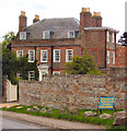
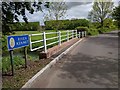
![Path leaves the road [2] in SN8 1QB](https://images.propbar.co.uk/images/geograph/63/58/6358668_120.jpg)
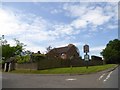
![Lockeridge houses [17] in SN8 1QB](https://images.propbar.co.uk/images/geograph/63/58/6358681_120.jpg)
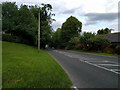
![Lockeridge houses [18] in SN8 1QB](https://images.propbar.co.uk/images/geograph/63/58/6358689_120.jpg)
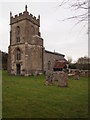
![Lockeridge houses [19] in SN8 1QB](https://images.propbar.co.uk/images/geograph/63/58/6358691_120.jpg)
54 photos from this area
Area Information
Key information about the SN8 1QB including its size, population, and administrative classification.
- Area Type
- Postcode
- Area Size
- 3.4 hectares
- Population
- 1761
- Population Density
- 23 people/km²
House Prices in SN8 1QB
6
Properties
£450,000
Average Sold Price
£330,000
Lowest Price
£565,000
Highest Price
Showing 6 properties
| Address | Type | Beds | Baths | Last Sale Price | Last Sale Date | |
|---|---|---|---|---|---|---|
| Tathra, Lockeridge House North C 38 To Bath Road, Fyfield, SN8 1QB | Bungalow | 3 | 2 | £565,000 | Aug 2024 | |
| Maydwel, Lockeridge House North C 38 To Bath Road, Fyfield, SN8 1QB | Bungalow | 3 | 1 | £355,000 | Sep 2017 | |
| The Firs, Lockeridge House North C 38 To Bath Road, Fyfield, SN8 1QB | house | - | - | £550,000 | Aug 2017 | |
| Churchview, Lockeridge House North C 38 To Bath Road, Fyfield, SN8 1QB | Detached | - | - | £330,000 | Jul 2009 | |
| 2, Chalk Ridge, Lockeridge House North C 38 To Bath Road, Fyfield, SN8 1QB | Semi-detached | - | - | - | - | |
| 1, Chalk Ridge, Lockeridge House North C 38 To Bath Road, Fyfield, SN8 1QB | Semi-detached | - | - | - | - |
Energy Efficiency in SN8 1QB
Amenities
Schools
| Rank | School | Type | Entry gender | Ages |
|---|
Explore more schools in this area
Go to Schools tabDemographics
Household Size
Two person
most common
Accommodation Type
Houses
most common
Tenure
64
majority
Ethnic Group
White
most common
Religion
N/A
most common
Household Composition
N/A
most common
Age
47
median
Adults (30-64 years)
most common
Household Deprivation
N/A
with no deprivation
NS-SEC
44
in Lower managerial occupations
Explore more demographic insights in this area
Go to Demographics tabPlanning
Planning Constraints
- Flood RiskPremium
- Ramsar Wetland SitesPremium
- Area of Outstanding Natural BeautyPremium
- Protected Nature ReservePremium
- Protected WoodlandPremium