Area Overview for SN8 1PX
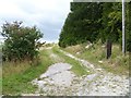
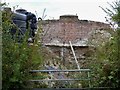
Photos of SN8 1PX
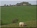
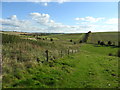
![Fyfield buildings [2] in SN8 1PX](https://images.propbar.co.uk/images/geograph/63/59/6359424_120.jpg)
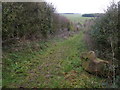
![Fyfield houses [2] in SN8 1PX](https://images.propbar.co.uk/images/geograph/63/59/6359429_120.jpg)
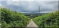
![Towards the downs [3] in SN8 1PX](https://images.propbar.co.uk/images/geograph/63/59/6359432_120.jpg)
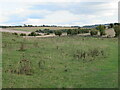
13 photos from this area
Area Information
Key information about the SN8 1PX including its size, population, and administrative classification.
- Area Type
- Postcode
- Area Size
- 2.2 km²
- Population
- 1761
- Population Density
- 23 people/km²
House Prices in SN8 1PX
8
Properties
£340,000
Average Sold Price
£120,000
Lowest Price
£582,500
Highest Price
Showing 8 properties
| Address | Type | Beds | Baths | Last Sale Price | Last Sale Date | |
|---|---|---|---|---|---|---|
| 28 Bath Road, Fyfield, SN8 1PX | Semi-detached | 3 | 1 | £430,000 | Nov 2020 | |
| Ridge House, Bath Road, Fyfield, SN8 1PX | house | - | - | £582,500 | Jul 2018 | |
| 29 Bath Road, Fyfield, SN8 1PX | house | - | - | £217,500 | Oct 2017 | |
| 25 Bath Road, Fyfield, SN8 1PX | Semi-detached | 3 | - | £350,000 | Aug 2015 | |
| 30 Bath Road, Fyfield, SN8 1PX | house | 3 | - | £120,000 | Sep 1999 | |
| 26 Bath Road, Fyfield, SN8 1PX | Semi-detached | - | - | - | - | |
| 27 Bath Road, Fyfield, SN8 1PX | house | - | - | - | - | |
| Whiteacre, 23 Bath Road, Fyfield, SN8 1PX | Detached | - | - | - | - |
Energy Efficiency in SN8 1PX
Amenities
Schools
| Rank | School | Type | Entry gender | Ages |
|---|
Explore more schools in this area
Go to Schools tabDemographics
Household Size
Two person
most common
Accommodation Type
Houses
most common
Tenure
64
majority
Ethnic Group
White
most common
Religion
N/A
most common
Household Composition
N/A
most common
Age
47
median
Adults (30-64 years)
most common
Household Deprivation
N/A
with no deprivation
NS-SEC
44
in Lower managerial occupations
Explore more demographic insights in this area
Go to Demographics tabPlanning
Planning Constraints
- Flood RiskPremium
- Ramsar Wetland SitesPremium
- Area of Outstanding Natural BeautyPremium
- Protected Nature ReservePremium
- Protected WoodlandPremium