Area Overview for SN15 2DS
Photos of SN15 2DS
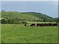
![Netherstreet Farm [1] in SN15 2DS](https://images.propbar.co.uk/images/geograph/52/33/5233503_120.jpg)
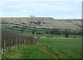
![Netherstreet Farm [2] in SN15 2DS](https://images.propbar.co.uk/images/geograph/52/33/5233506_120.jpg)
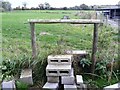
![Cottages on Netherstreet [1] in SN15 2DS](https://images.propbar.co.uk/images/geograph/52/33/5233516_120.jpg)
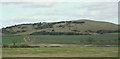
![Cottages on Netherstreet [2] in SN15 2DS](https://images.propbar.co.uk/images/geograph/52/33/5233518_120.jpg)
![Cottages on Netherstreet [3] in SN15 2DS](https://images.propbar.co.uk/images/geograph/52/33/5233522_120.jpg)
![Netherstreet Farm [3] in SN15 2DS](https://images.propbar.co.uk/images/geograph/52/33/5233924_120.jpg)
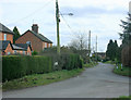
![Three ways to go [1] in SN15 2DS](https://images.propbar.co.uk/images/geograph/52/33/5233927_120.jpg)
27 photos from this area
Area Information
Key information about the SN15 2DS including its size, population, and administrative classification.
- Area Type
- Postcode
- Area Size
- 96.2 hectares
- Population
- 1546
- Population Density
- 119 people/km²
House Prices in SN15 2DS
9
Properties
£422,500
Average Sold Price
£200,000
Lowest Price
£645,000
Highest Price
Showing 9 properties
| Address | Type | Beds | Baths | Last Sale Price | Last Sale Date | |
|---|---|---|---|---|---|---|
| 92 Netherstreet, Bromham, SN15 2DS | house | 4 | - | £645,000 | Apr 2012 | |
| 100 Netherstreet, Bromham, SN15 2DS | house | - | - | £200,000 | Feb 2000 | |
| Green Pioneer Limited, Netherstreet Farm, Netherstreet, Bromham, SN15 2DS | office_workshop | - | - | - | - | |
| 123 Netherstreet, Bromham, SN15 2DS | Terraced | - | - | - | - | |
| 121 Netherstreet, Bromham, SN15 2DS | Terraced | - | - | - | - | |
| 117 Netherstreet, Bromham, SN15 2DS | Terraced | - | - | - | - | |
| 119 Netherstreet, Bromham, SN15 2DS | Terraced | - | - | - | - | |
| Netherstreet Farm, Netherstreet, Bromham, SN15 2DS | Detached | - | - | - | - | |
| Cookery School, Netherstreet Farm, Netherstreet, Bromham, SN15 2DS | office_workshop | - | - | - | - |
Energy Efficiency in SN15 2DS
Amenities
Schools
| Rank | School | Type | Entry gender | Ages |
|---|
Explore more schools in this area
Go to Schools tabDemographics
Household Size
Two person
most common
Accommodation Type
Houses
most common
Tenure
66
majority
Ethnic Group
White
most common
Religion
N/A
most common
Household Composition
N/A
most common
Age
47
median
Adults (30-64 years)
most common
Household Deprivation
N/A
with no deprivation
NS-SEC
35
in Lower managerial occupations
Explore more demographic insights in this area
Go to Demographics tabPlanning
Planning Constraints
- Flood RiskPremium
- Ramsar Wetland SitesPremium
- Area of Outstanding Natural BeautyPremium
- Protected Nature ReservePremium
- Protected WoodlandPremium