Area Overview for SN10 5UY
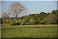
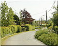
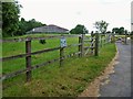
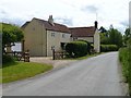
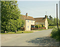
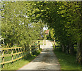
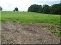
Photos of SN10 5UY
![Along the field edge [1] in SN10 5UY](https://images.propbar.co.uk/images/geograph/62/06/6206767_120.jpg)
![Wonderful Wiltshire [1] in SN10 5UY](https://images.propbar.co.uk/images/geograph/62/06/6206772_120.jpg)
![Wonderful Wiltshire [2] in SN10 5UY](https://images.propbar.co.uk/images/geograph/62/06/6206773_120.jpg)
![Over the stile [1] in SN10 5UY](https://images.propbar.co.uk/images/geograph/62/06/6206764_120.jpg)
![Horse paddock [1] in SN10 5UY](https://images.propbar.co.uk/images/geograph/62/06/6206776_120.jpg)
24 photos from this area
Area Information
Key information about the SN10 5UY including its size, population, and administrative classification.
- Area Type
- Postcode
- Area Size
- 7.7 hectares
- Population
- 2153
- Population Density
- 78 people/km²
House Prices in SN10 5UY
13
Properties
£423,571
Average Sold Price
£135,000
Lowest Price
£650,000
Highest Price
Showing 13 properties
| Address | Type | Beds | Baths | Last Sale Price | Last Sale Date | |
|---|---|---|---|---|---|---|
| 80 The Green, Great Cheverell, SN10 5UY | Bungalow | 4 | 2 | £380,000 | Jun 2020 | |
| Strawberry Bank, 88 The Green, Great Cheverell, SN10 5UY | Detached | 4 | 2 | £582,000 | Feb 2020 | |
| Trelawny, 86 The Green, Great Cheverell, SN10 5UY | Bungalow | - | - | £465,000 | Apr 2019 | |
| Green Gables, 62 The Green, Great Cheverell, SN10 5UY | Land | - | - | £378,000 | May 2018 | |
| 96 The Green, Great Cheverell, SN10 5UY | house | - | - | £375,000 | Apr 2017 | |
| Rose Cottage, 78 The Green, Great Cheverell, SN10 5UY | house | - | - | £650,000 | Apr 2016 | |
| End Cottage, 102 The Green, Great Cheverell, SN10 5UY | Detached | 4 | 2 | £135,000 | Sep 1997 | |
| 84 The Green, Great Cheverell, SN10 5UY | Detached | 3 | 1 | - | - | |
| 82 The Green, Great Cheverell, SN10 5UY | Detached | 3 | 1 | - | - | |
| 64-66 The Green, Great Cheverell, SN10 5UY | Land | - | - | - | - |
Page 1 of 2
Energy Efficiency in SN10 5UY
Amenities
Schools
| Rank | School | Type | Entry gender | Ages |
|---|
Explore more schools in this area
Go to Schools tabDemographics
Household Size
Two person
most common
Accommodation Type
Houses
most common
Tenure
79
majority
Ethnic Group
White
most common
Religion
N/A
most common
Household Composition
N/A
most common
Age
47
median
Adults (30-64 years)
most common
Household Deprivation
N/A
with no deprivation
NS-SEC
35
in Lower managerial occupations
Explore more demographic insights in this area
Go to Demographics tabPlanning
Planning Constraints
- Flood RiskPremium
- Ramsar Wetland SitesPremium
- Area of Outstanding Natural BeautyPremium
- Protected Nature ReservePremium
- Protected WoodlandPremium