Area Overview for SN10 5UT
Photos of SN10 5UT
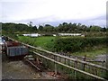
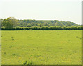
![Spot the path [2] in SN10 5UT](https://images.propbar.co.uk/images/geograph/44/88/4488954_120.jpg)
17 photos from this area
Area Information
Key information about the SN10 5UT including its size, population, and administrative classification.
- Area Type
- Postcode
- Area Size
- 61.4 hectares
- Population
- 2153
- Population Density
- 78 people/km²
House Prices in SN10 5UT
5
Properties
-
Average Sold Price
-
Lowest Price
-
Highest Price
Showing 5 properties
| Address | Type | Beds | Baths | Last Sale Price | Last Sale Date | |
|---|---|---|---|---|---|---|
| Mobile Home, Witchcombe Farm, Witchcombe Lane, Great Cheverell, SN10 5UT | Mobile Home | - | - | - | - | |
| Common Farm Lodge, Common Lane, Great Cheverell, SN10 5UT | house | - | - | - | - | |
| Bungalow, Witchcombe Farm, Witchcombe Lane, Great Cheverell, SN10 5UT | Detached | - | - | - | - | |
| Common Farm Cottage, Common Lane, Great Cheverell, SN10 5UT | Semi-detached | - | - | - | - | |
| Common Farm House, Common Lane, Great Cheverell, SN10 5UT | house | - | - | - | - |
Energy Efficiency in SN10 5UT
Amenities
Schools
| Rank | School | Type | Entry gender | Ages |
|---|
Explore more schools in this area
Go to Schools tabDemographics
Household Size
Two person
most common
Accommodation Type
Houses
most common
Tenure
79
majority
Ethnic Group
White
most common
Religion
N/A
most common
Household Composition
N/A
most common
Age
47
median
Adults (30-64 years)
most common
Household Deprivation
N/A
with no deprivation
NS-SEC
35
in Lower managerial occupations
Explore more demographic insights in this area
Go to Demographics tabPlanning
Planning Constraints
- Flood RiskPremium
- Ramsar Wetland SitesPremium
- Area of Outstanding Natural BeautyPremium
- Protected Nature ReservePremium
- Protected WoodlandPremium