Area Overview for SN10 5XN
Photos of SN10 5XN
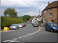
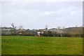
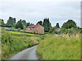
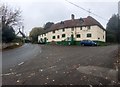
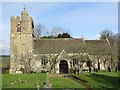
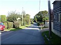
![Houses in Great Cheverell [1] in SN10 5XN](https://images.propbar.co.uk/images/geograph/55/73/5573891_120.jpg)
40 photos from this area
Area Information
Key information about the SN10 5XN including its size, population, and administrative classification.
- Area Type
- Postcode
- Area Size
- 8.7 hectares
- Population
- 2153
- Population Density
- 78 people/km²
House Prices in SN10 5XN
16
Properties
£231,571
Average Sold Price
£100,000
Lowest Price
£350,000
Highest Price
Showing 16 properties
| Address | Type | Beds | Baths | Last Sale Price | Last Sale Date | |
|---|---|---|---|---|---|---|
| Wellingtonia, 9 The Green, Great Cheverell, SN10 5XN | Bungalow | 2 | 1 | £240,000 | Nov 2023 | |
| Goodfellows, 4 The Green, Great Cheverell, SN10 5XN | house | 3 | - | £236,000 | Apr 2011 | |
| 15 The Green, Great Cheverell, SN10 5XN | Detached | - | - | £280,000 | Mar 2004 | |
| Beech House, 17 The Green, Great Cheverell, SN10 5XN | Detached | - | - | £350,000 | Aug 2002 | |
| Canty Lye, 19 The Green, Great Cheverell, SN10 5XN | Detached | - | - | £225,000 | Jul 2000 | |
| The Green Farm, 12 The Green, Great Cheverell, SN10 5XN | Land | - | - | £190,000 | Jun 1999 | |
| Plum Tree Lodge, 9A The Green, Great Cheverell, SN10 5XN | Detached | - | - | £100,000 | Apr 1995 | |
| COLWYN, 14 THE GREEN, Great Cheverell, SN10 5XN | Detached | 3 | 1 | - | - | |
| Chapel House, 1 The Green, Great Cheverell, SN10 5XN | Detached | 2 | 1 | - | - | |
| Holiday Let, Chapel House, 1 The Green, Great Cheverell, SN10 5XN | hotel | - | - | - | - |
Page 1 of 2
Energy Efficiency in SN10 5XN
Amenities
Schools
| Rank | School | Type | Entry gender | Ages |
|---|
Explore more schools in this area
Go to Schools tabDemographics
Household Size
Two person
most common
Accommodation Type
Houses
most common
Tenure
79
majority
Ethnic Group
White
most common
Religion
N/A
most common
Household Composition
N/A
most common
Age
47
median
Adults (30-64 years)
most common
Household Deprivation
N/A
with no deprivation
NS-SEC
35
in Lower managerial occupations
Explore more demographic insights in this area
Go to Demographics tabPlanning
Planning Constraints
- Flood RiskPremium
- Ramsar Wetland SitesPremium
- Area of Outstanding Natural BeautyPremium
- Protected Nature ReservePremium
- Protected WoodlandPremium