Area Overview for SN10 5TP
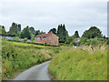
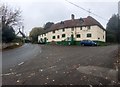
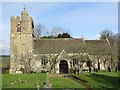
Photos of SN10 5TP
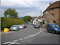
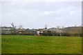
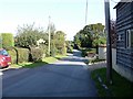
![Houses in Great Cheverell [1] in SN10 5TP](https://images.propbar.co.uk/images/geograph/55/73/5573891_120.jpg)

40 photos from this area
Area Information
Key information about the SN10 5TP including its size, population, and administrative classification.
- Area Type
- Postcode
- Area Size
- 4.4 hectares
- Population
- 2153
- Population Density
- 78 people/km²
House Prices in SN10 5TP
16
Properties
£242,427
Average Sold Price
£79,995
Lowest Price
£425,000
Highest Price
Showing 16 properties
| Address | Type | Beds | Baths | Last Sale Price | Last Sale Date | |
|---|---|---|---|---|---|---|
| 7 Weavers Mead, Great Cheverell, SN10 5TP | Semi-detached | 3 | 3 | £425,000 | Apr 2023 | |
| 4 Weavers Mead, Great Cheverell, SN10 5TP | house | - | - | £307,000 | Mar 2021 | |
| 1 Weavers Mead, Great Cheverell, SN10 5TP | Detached | 4 | 1 | £350,000 | Jun 2020 | |
| 3 Weavers Mead, Great Cheverell, SN10 5TP | Semi-detached | - | - | £205,000 | May 2007 | |
| 6 Weavers Mead, Great Cheverell, SN10 5TP | Semi-detached | - | - | £248,000 | Dec 2006 | |
| 2 Weavers Mead, Great Cheverell, SN10 5TP | Semi-detached | - | - | £81,995 | Jun 1998 | |
| 5 Weavers Mead, Great Cheverell, SN10 5TP | Semi-detached | - | - | £79,995 | Apr 1998 | |
| 17 Weavers Mead, Great Cheverell, SN10 5TP | house | - | - | - | - | |
| 11 Weavers Mead, Great Cheverell, SN10 5TP | house | - | - | - | - | |
| 8 Weavers Mead, Great Cheverell, SN10 5TP | house | - | - | - | - |
Page 1 of 2
Energy Efficiency in SN10 5TP
Amenities
Schools
| Rank | School | Type | Entry gender | Ages |
|---|
Explore more schools in this area
Go to Schools tabDemographics
Household Size
Two person
most common
Accommodation Type
Houses
most common
Tenure
79
majority
Ethnic Group
White
most common
Religion
N/A
most common
Household Composition
N/A
most common
Age
47
median
Adults (30-64 years)
most common
Household Deprivation
N/A
with no deprivation
NS-SEC
35
in Lower managerial occupations
Explore more demographic insights in this area
Go to Demographics tabPlanning
Planning Constraints
- Flood RiskPremium
- Ramsar Wetland SitesPremium
- Area of Outstanding Natural BeautyPremium
- Protected Nature ReservePremium
- Protected WoodlandPremium