Area Overview for PL1 3RN
Photos of PL1 3RN
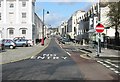

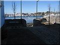

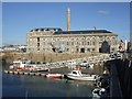
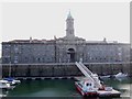
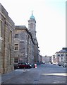

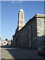
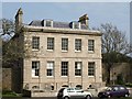
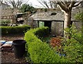
100 photos from this area
Area Information
Key information about the PL1 3RN including its size, population, and administrative classification.
- Area Type
- Postcode
- Area Size
- 8138 m²
- Population
- 1043
- Population Density
- 3226 people/km²
House Prices in PL1 3RN
12
Properties
£254,992
Average Sold Price
£155,000
Lowest Price
£380,000
Highest Price
Showing 12 properties
| Address | Type | Beds | Baths | Last Sale Price | Last Sale Date | |
|---|---|---|---|---|---|---|
| 5 Freemans Wharf, Plymouth, PL1 3RN | Retail | 2 | 1 | £380,000 | Jun 2022 | |
| 12 Freemans Wharf, Plymouth, PL1 3RN | Terraced | 3 | 2 | £288,000 | Sep 2020 | |
| 8 Freemans Wharf, Plymouth, PL1 3RN | Flat | - | - | £250,000 | Jul 2019 | |
| 10 Freemans Wharf, Plymouth, PL1 3RN | Terraced | 2 | 1 | £235,000 | Apr 2019 | |
| 11 Freemans Wharf, Plymouth, PL1 3RN | Terraced | 3 | 2 | £292,000 | Jul 2016 | |
| 9 Freemans Wharf, Plymouth, PL1 3RN | Flat | - | - | £229,950 | May 2007 | |
| 1 FREEMANS WHARF, Plymouth, PL1 3RN | Terraced | - | - | £365,000 | Mar 2007 | |
| 4 Freemans Wharf, Plymouth, PL1 3RN | Semi-detached | 2 | 1 | £260,000 | May 2004 | |
| 7 Freemans Wharf, Plymouth, PL1 3RN | Flat | 2 | - | £155,000 | Jun 2002 | |
| 2 Freemans Wharf, Plymouth, PL1 3RN | Terraced | - | - | £245,000 | Mar 2002 |
Page 1 of 2
Energy Efficiency in PL1 3RN
Amenities
Schools
| Rank | School | Type | Entry gender | Ages |
|---|
Explore more schools in this area
Go to Schools tabDemographics
Household Size
One person
most common
Accommodation Type
Flats
most common
Tenure
42
majority
Ethnic Group
White
most common
Religion
N/A
most common
Household Composition
N/A
most common
Age
47
median
Adults (30-64 years)
most common
Household Deprivation
N/A
with no deprivation
NS-SEC
40
in Lower managerial occupations
Explore more demographic insights in this area
Go to Demographics tabPlanning
Planning Constraints
- Flood RiskPremium
- Ramsar Wetland SitesPremium
- Area of Outstanding Natural BeautyPremium
- Protected Nature ReservePremium
- Protected WoodlandPremium