Area Overview for PL1 3RB
Photos of PL1 3RB
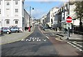
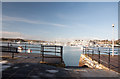
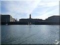
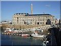
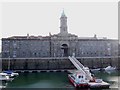
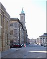
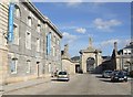
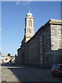
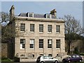
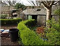
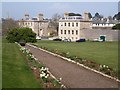
100 photos from this area
Area Information
Key information about the PL1 3RB including its size, population, and administrative classification.
- Area Type
- Postcode
- Area Size
- 8785 m²
- Population
- 1043
- Population Density
- 3226 people/km²
House Prices in PL1 3RB
15
Properties
£202,667
Average Sold Price
£160,000
Lowest Price
£300,000
Highest Price
Showing 15 properties
| Address | Type | Beds | Baths | Last Sale Price | Last Sale Date | |
|---|---|---|---|---|---|---|
| 128 Cremyll Street, Plymouth, PL1 3RB | house | - | - | £200,000 | Aug 2023 | |
| THE VICTUALLING OFFICE TAVERN, 10 CREMYLL STREET, Plymouth, PL1 3RB | Semi-detached | - | - | £300,000 | Feb 2022 | |
| 17 Cremyll Street, Plymouth, PL1 3RB | Bungalow | - | - | £160,000 | May 2021 | |
| 115 Cremyll Street, Plymouth, PL1 3RB | Terraced | - | - | £220,000 | Oct 2014 | |
| 130 Cremyll Street, Plymouth, PL1 3RB | house | - | - | £270,000 | Aug 2009 | |
| 114 Cremyll Street, Plymouth, PL1 3RB | Semi-detached | - | - | £164,000 | May 2008 | |
| 17A Cremyll Street, Plymouth, PL1 3RB | Terraced | - | - | £185,000 | Aug 2006 | |
| 18 Cremyll Street, Plymouth, PL1 3RB | Bungalow | 2 | 1 | £160,000 | Dec 2003 | |
| 19 Cremyll Street, Plymouth, PL1 3RB | Terraced | 4 | 3 | £165,000 | Oct 1999 | |
| 116 Cremyll Street, Plymouth, PL1 3RB | Semi-detached | 2 | 1 | - | - |
Page 1 of 2
Energy Efficiency in PL1 3RB
Amenities
Schools
| Rank | School | Type | Entry gender | Ages |
|---|
Explore more schools in this area
Go to Schools tabDemographics
Household Size
One person
most common
Accommodation Type
Flats
most common
Tenure
42
majority
Ethnic Group
White
most common
Religion
N/A
most common
Household Composition
N/A
most common
Age
47
median
Adults (30-64 years)
most common
Household Deprivation
N/A
with no deprivation
NS-SEC
40
in Lower managerial occupations
Explore more demographic insights in this area
Go to Demographics tabPlanning
Planning Constraints
- Flood RiskPremium
- Ramsar Wetland SitesPremium
- Area of Outstanding Natural BeautyPremium
- Protected Nature ReservePremium
- Protected WoodlandPremium