Area Overview for PL1 3RL
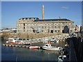
Photos of PL1 3RL


Area Information
PL1 3RL is a compact residential postcode covering just 1.1 hectares with a population of 1,043 residents. This small cluster creates a tightly knit environment where neighbours are likely to know one another. The high population density indicates a close-knit community setting rather than an expansive suburban sprawl. Living in this specific postcode means you are part of a distinct residential zone within the wider Plymouth area. The concentration of people in such a small space suggests a neighbourhood designed for proximity rather than seclusion. Daily life here revolves around the immediate surroundings of this postcode boundary. Residents navigate a space that is both intimate and defined by its specific geographical limits. You will find a community where space is shared and land use is efficiently organised. This area represents a specific slice of Plymouth's housing landscape. The small size means that changes to the built environment are noticeable to every resident. Your view of the daily rhythm of PL1 3RL will be shaped by this contained nature.
- Area Type
- Postcode
- Area Size
- 1.1 hectares
- Population
- 1043
- Population Density
- 3226 people/km²
Homes in PL1 3RL represent a market where flats dominate the housing stock. This accommodation type is the most common form of dwelling within the postcode boundary. Only 42% of residents own their homes outright, indicating a significant private rental market component. This ownership split affects transaction dynamics for anyone looking to buy or sell property in this location. The prevalence of flats suggests a property mix likely favoured by professionals or those seeking lower-maintenance living. You will find that traditional detached housing floors family is not the primary model here. The high population density of over 96,000 people per square kilometre reinforces the nature of this urban residential cluster. Buying property in PL1 3RL means entering a dense environment where land value is maximised through vertical living. The closed nature of flats often creates a specific management structure for the streets and communal areas. Potential owners must consider the implications of this high-density flat-led market. The 58% rental proportion also means you enter a community where tenant turnover may be more frequent than in conservative owner-occupied suburbs.
House Prices in PL1 3RL
Showing 19 properties
| Address | Type | Beds | Baths | Last Sale Price | Last Sale Date | |
|---|---|---|---|---|---|---|
| 6, The Quarterdeck, Strand Street, Plymouth, PL1 3RL | Flat | 2 | 2 | - | - | |
| 9, The Quarterdeck, Strand Street, Plymouth, PL1 3RL | Flat | 3 | 2 | - | - | |
| 7, The Quarterdeck, Strand Street, Plymouth, PL1 3RL | Flat | 3 | 1 | - | - | |
| 3, The Quarterdeck, Strand Street, Plymouth, PL1 3RL | Flat | 2 | 2 | - | - | |
| 1, The Quarterdeck, Strand Street, Plymouth, PL1 3RL | Flat | 2 | 1 | - | - | |
| 19, The Quarterdeck, Strand Street, Plymouth, PL1 3RL | Semi-detached | 2 | 1 | - | - | |
| 20, The Quarterdeck, Strand Street, Plymouth, PL1 3RL | Flat | 2 | - | - | - | |
| 8, The Quarterdeck, Strand Street, Plymouth, PL1 3RL | Flat | - | - | - | - | |
| 14, The Quarterdeck, Strand Street, Plymouth, PL1 3RL | Flat | - | - | - | - | |
| 15, The Quarterdeck, Strand Street, Plymouth, PL1 3RL | Flat | - | - | - | - |
Energy Efficiency in PL1 3RL
Living in PL1 3RL offers immediate access to a wide range of amenities designed for convenience. Five ferry terminals operate nearby, including Plymouth Stonehouse Ferry Terminal and Royal William Yard Ferry Landing. This variety allows for flexible maritime travel and commuting options. You can reach retail outlets including Lidl Central, Tesco Devonport, and Aldi Plymouth with ease. These supermarkets provide daily shopping needs within a practical distance for residents. Five railway stations such as Devonport Railway Station and Dockyard Railway Station are accessible to this postcode. Two airports, both Plymouth City Airport, offer air travel connections for longer journeys. This concentration of transport and retail hubs means you rarely need to venture far for essential services. The street-level access to these facilities defines the lifestyle rhythm for anyone calling PL1 3RL home. Your weekly routine can easily incorporate trips to these named venues without significant travel time. The presence of multiple ferry options also opens up potential leisure activities beyond the city. This amenity-rich environment supports a self-contained daily life for the majority of residents.
Amenities
Schools
Parents considering schools near PL1 3RL have two primary options within walking distance. St George's CofE Primary School serves as a primary option for families in the immediate vicinity. This institution offers a Church of England education for young children in the neighbourhood. There is also St George's CofE Primary Academy nearby, which holds a good Ofsted rating. This designation confirms the academy meets high educational standards as judged by inspectors. Having two schools both identified as Church of England primary institutions means the local area provides a consistent religious educational environment. You do not have to look far for schooling support given the proximity of these two venues. The presence of a rated academy adds a layer of security and quality assurance for those prioritising educational outcomes. Filling with your children in PL1 3RL grants them access to established primary education without long commutes. These schools represent the main anchors for family life within this small postcode area.
| Rank | School | Type | Entry gender | Ages |
|---|
Explore more schools in this area
Go to Schools tabDemographics
The community profile in PL1 3RL reflects a mature demographic with a median age of 47 years. Adults aged between 30 and 64 years constitute the most common age range within this cluster. This ageing profile suggests a neighbourhood primarily suited to established households or those in the second half of their working lives. Home ownership stands at 42%, meaning a significant portion of residents rent their homes. The dominant accommodation type consists of flats, which aligns with the popularity of ownership in this specific area. White residents form the predominant ethnic group according to the latest figures. You are looking at a stable environment where long-term residents likely hold significant sway over local dynamics. The median age of 47 years indicates that young families may be a smaller segment of the population. Ending with a population density of 96,764 people per square kilometre, the area is exceptionally crowded for a residential cluster. This density impacts how residents interact with shared spaces and public facilities. The high concentration of people in 1.1 hectares creates specific social and logistical pressures on the local infrastructure.
Household Size
Accommodation Type
Tenure
Ethnic Group
Religion
Household Composition
Age
Household Deprivation
NS-SEC
Explore more demographic insights in this area
Go to Demographics tabPlanning
Planning Constraints
- Flood RiskPremium
- Ramsar Wetland SitesPremium
- Area of Outstanding Natural BeautyPremium
- Protected Nature ReservePremium
- Protected WoodlandPremium