Area Overview for GL51 9HZ
Photos of GL51 9HZ

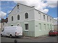
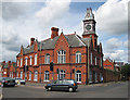
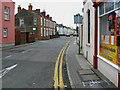
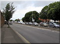

86 photos from this area
Area Information
Key information about the GL51 9HZ including its size, population, and administrative classification.
- Area Type
- Postcode
- Area Size
- 5772 m²
- Population
- 1666
- Population Density
- 7532 people/km²
House Prices in GL51 9HZ
31
Properties
£179,443
Average Sold Price
£55,000
Lowest Price
£370,000
Highest Price
Showing 31 properties
| Address | Type | Beds | Baths | Last Sale Price | Last Sale Date | |
|---|---|---|---|---|---|---|
| 199 Swindon Road, Cheltenham, GL51 9HZ | Terraced | 4 | 2 | £212,500 | Jan 2025 | |
| 217 Swindon Road, Cheltenham, GL51 9HZ | Terraced | 2 | 1 | £200,000 | Jun 2021 | |
| 225 Swindon Road, Cheltenham, GL51 9HZ | house | - | - | £209,000 | May 2021 | |
| 229 Swindon Road, Cheltenham, GL51 9HZ | Terraced | 2 | - | £183,000 | Mar 2021 | |
| 205 Swindon Road, Cheltenham, GL51 9HZ | Terraced | - | - | £175,000 | Jan 2021 | |
| 215 Swindon Road, Cheltenham, GL51 9HZ | Terraced | 2 | 1 | £187,500 | Aug 2019 | |
| 233 Swindon Road, Cheltenham, GL51 9HZ | Semi-detached | 3 | 1 | £225,000 | Mar 2019 | |
| 207 Swindon Road, Cheltenham, GL51 9HZ | Terraced | 1 | 1 | £230,000 | Oct 2018 | |
| 195 Swindon Road, Cheltenham, GL51 9HZ | Terraced | 4 | 1 | £193,000 | Dec 2017 | |
| 249 Swindon Road, Cheltenham, GL51 9HZ | house | - | - | £370,000 | Mar 2016 |
Page 1 of 4
Energy Efficiency in GL51 9HZ
Amenities
Schools
| Rank | School | Type | Entry gender | Ages |
|---|
Explore more schools in this area
Go to Schools tabDemographics
Household Size
One person
most common
Accommodation Type
Houses
most common
Tenure
40
majority
Ethnic Group
White
most common
Religion
N/A
most common
Household Composition
N/A
most common
Age
22
median
Young Adults (15-29 years)
most common
Household Deprivation
N/A
with no deprivation
NS-SEC
20
in Lower managerial occupations
Explore more demographic insights in this area
Go to Demographics tabPlanning
Planning Constraints
- Flood RiskPremium
- Ramsar Wetland SitesPremium
- Area of Outstanding Natural BeautyPremium
- Protected Nature ReservePremium
- Protected WoodlandPremium