Area Overview for GL51 9JB
Photos of GL51 9JB

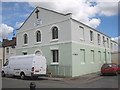
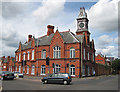
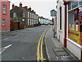
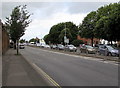
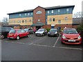
86 photos from this area
Area Information
Key information about the GL51 9JB including its size, population, and administrative classification.
- Area Type
- Postcode
- Area Size
- 2.3 hectares
- Population
- 1666
- Population Density
- 7532 people/km²
House Prices in GL51 9JB
52
Properties
£148,988
Average Sold Price
£25,000
Lowest Price
£261,650
Highest Price
Showing 52 properties
| Address | Type | Beds | Baths | Last Sale Price | Last Sale Date | |
|---|---|---|---|---|---|---|
| 40 Marsh Lane, Cheltenham, GL51 9JB | Terraced | 2 | 1 | £240,000 | Jul 2024 | |
| 8 Marsh Lane, Cheltenham, GL51 9JB | Terraced | 3 | 2 | £236,000 | Jun 2024 | |
| 50 Marsh Lane, Cheltenham, GL51 9JB | Terraced | 2 | 1 | £250,000 | Jan 2024 | |
| 10 Marsh Lane, Cheltenham, GL51 9JB | Terraced | 3 | 1 | £245,000 | May 2022 | |
| 6 Marsh Lane, Cheltenham, GL51 9JB | house | - | - | £165,000 | Mar 2022 | |
| 4 Marsh Lane, Cheltenham, GL51 9JB | Terraced | 3 | 1 | £261,650 | Jan 2022 | |
| 46 Marsh Lane, Cheltenham, GL51 9JB | Terraced | 2 | 1 | £198,000 | Jul 2020 | |
| 34 Marsh Lane, Cheltenham, GL51 9JB | Terraced | 2 | 1 | £200,000 | Nov 2019 | |
| 24 Marsh Lane, Cheltenham, GL51 9JB | Terraced | 2 | 1 | £232,500 | May 2019 | |
| 62 Marsh Lane, Cheltenham, GL51 9JB | house | - | - | £162,500 | Apr 2019 |
Page 1 of 6
Energy Efficiency in GL51 9JB
Amenities
Schools
| Rank | School | Type | Entry gender | Ages |
|---|
Explore more schools in this area
Go to Schools tabDemographics
Household Size
One person
most common
Accommodation Type
Houses
most common
Tenure
40
majority
Ethnic Group
White
most common
Religion
N/A
most common
Household Composition
N/A
most common
Age
22
median
Young Adults (15-29 years)
most common
Household Deprivation
N/A
with no deprivation
NS-SEC
20
in Lower managerial occupations
Explore more demographic insights in this area
Go to Demographics tabPlanning
Planning Constraints
- Flood RiskPremium
- Ramsar Wetland SitesPremium
- Area of Outstanding Natural BeautyPremium
- Protected Nature ReservePremium
- Protected WoodlandPremium