Area Overview for GL5 4HQ
Photos of GL5 4HQ
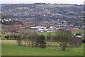
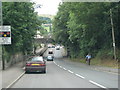
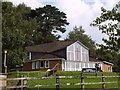
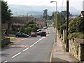

100 photos from this area
Area Information
Key information about the GL5 4HQ including its size, population, and administrative classification.
- Area Type
- Postcode
- Area Size
- 1.1 hectares
- Population
- 1208
- Population Density
- 2039 people/km²
House Prices in GL5 4HQ
30
Properties
£175,692
Average Sold Price
£35,000
Lowest Price
£275,000
Highest Price
Showing 30 properties
| Address | Type | Beds | Baths | Last Sale Price | Last Sale Date | |
|---|---|---|---|---|---|---|
| 17 Central Road, Stroud, GL5 4HQ | Semi-detached | 2 | 1 | £270,000 | Mar 2025 | |
| 20 Central Road, Stroud, GL5 4HQ | Semi-detached | 3 | 2 | £250,000 | Sep 2023 | |
| 23 Central Road, Stroud, GL5 4HQ | Retail | 2 | 1 | £205,000 | Oct 2022 | |
| 19 Central Road, Stroud, GL5 4HQ | house | - | - | £275,000 | Apr 2022 | |
| 27 Central Road, Stroud, GL5 4HQ | Terraced | 2 | 2 | £210,000 | Sep 2021 | |
| 13 Central Road, Stroud, GL5 4HQ | house | - | - | £215,000 | Aug 2021 | |
| 12 Central Road, Stroud, GL5 4HQ | Terraced | 3 | - | £236,001 | Nov 2020 | |
| 5 Central Road, Stroud, GL5 4HQ | Semi-detached | 3 | 1 | £225,000 | Jul 2018 | |
| 14 Central Road, Stroud, GL5 4HQ | house | 2 | - | £155,000 | Dec 2015 | |
| 26 Central Road, Stroud, GL5 4HQ | house | 2 | - | £143,000 | Apr 2015 |
Page 1 of 3
Energy Efficiency in GL5 4HQ
Amenities
Schools
| Rank | School | Type | Entry gender | Ages |
|---|
Explore more schools in this area
Go to Schools tabDemographics
Household Size
Family (3-5 people)
most common
Accommodation Type
Houses
most common
Tenure
67
majority
Ethnic Group
White
most common
Religion
N/A
most common
Household Composition
N/A
most common
Age
47
median
Adults (30-64 years)
most common
Household Deprivation
N/A
with no deprivation
NS-SEC
36
in Lower managerial occupations
Explore more demographic insights in this area
Go to Demographics tabPlanning
Planning Constraints
- Flood RiskPremium
- Ramsar Wetland SitesPremium
- Area of Outstanding Natural BeautyPremium
- Protected Nature ReservePremium
- Protected WoodlandPremium