Area Overview for GL5 4EN
Photos of GL5 4EN
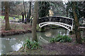
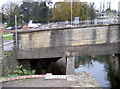
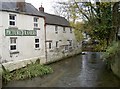
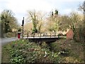
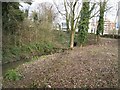
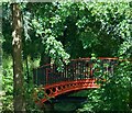
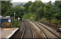


100 photos from this area
Area Information
Key information about the GL5 4EN including its size, population, and administrative classification.
- Area Type
- Postcode
- Area Size
- 1.8 hectares
- Population
- 1208
- Population Density
- 2039 people/km²
House Prices in GL5 4EN
77
Properties
£219,048
Average Sold Price
£73,330
Lowest Price
£390,000
Highest Price
Showing 77 properties
| Address | Type | Beds | Baths | Last Sale Price | Last Sale Date | |
|---|---|---|---|---|---|---|
| 26 Graces Field, Stroud, GL5 4EN | Semi-detached | 4 | 2 | £390,000 | Jan 2025 | |
| 41 Graces Field, Stroud, GL5 4EN | Terraced | 2 | 2 | £171,000 | Dec 2024 | |
| 10 Graces Field, Stroud, GL5 4EN | Semi-detached | 3 | 2 | £292,000 | Dec 2024 | |
| 72 Graces Field, Stroud, GL5 4EN | Maisonette | 3 | - | £73,330 | Dec 2024 | |
| 12 Graces Field, Stroud, GL5 4EN | Semi-detached | 3 | 1 | £335,000 | Nov 2024 | |
| 5 Graces Field, Stroud, GL5 4EN | Terraced | 3 | 2 | £325,000 | Nov 2024 | |
| 21 Graces Field, Stroud, GL5 4EN | Semi-detached | 3 | 2 | £330,000 | Jul 2024 | |
| 45 Graces Field, Stroud, GL5 4EN | Terraced | 3 | 2 | £239,400 | Apr 2024 | |
| 9 Graces Field, Stroud, GL5 4EN | Semi-detached | 3 | 2 | £318,000 | Oct 2023 | |
| 61 Graces Field, Stroud, GL5 4EN | house | - | - | £106,000 | Sep 2023 |
Page 1 of 8
Energy Efficiency in GL5 4EN
Amenities
Schools
| Rank | School | Type | Entry gender | Ages |
|---|
Explore more schools in this area
Go to Schools tabDemographics
Household Size
Family (3-5 people)
most common
Accommodation Type
Houses
most common
Tenure
67
majority
Ethnic Group
White
most common
Religion
N/A
most common
Household Composition
N/A
most common
Age
47
median
Adults (30-64 years)
most common
Household Deprivation
N/A
with no deprivation
NS-SEC
36
in Lower managerial occupations
Explore more demographic insights in this area
Go to Demographics tabPlanning
Planning Constraints
- Flood RiskPremium
- Ramsar Wetland SitesPremium
- Area of Outstanding Natural BeautyPremium
- Protected Nature ReservePremium
- Protected WoodlandPremium