Area Overview for GL14 2RT
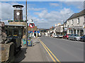
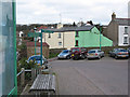
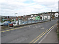
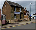
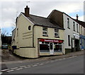
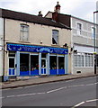
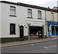
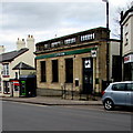
Photos of GL14 2RT


Area Information
GL14 2RT is a compact residential postcode area in England, covering 2,755 square metres and home to 2,091 residents. With a population density of 621 people per square kilometre, this small cluster of homes reflects a tight-knit community. The area is characterised by its focus on single-family dwellings, with houses forming the predominant accommodation type. Daily life here is shaped by proximity to local amenities and a mix of retail and transport options. While the area lacks large-scale infrastructure, its manageable size ensures a sense of familiarity for residents. The demographic profile suggests a mature population, with a median age of 47 and most residents falling within the 30–64 age bracket. This balance of stability and practicality makes GL14 2RT a viable option for those seeking a settled, low-maintenance lifestyle without the pressures of urban living. The area’s small footprint means that residents are likely to know their neighbours, and local services are within walking or short driving distance. For buyers, this postcode offers a snapshot of rural England’s quieter, more subdued living environment, with a focus on community over commercial sprawl.
- Area Type
- Postcode
- Area Size
- 2755 m²
- Population
- 2091
- Population Density
- 621 people/km²
The property market in GL14 2RT is dominated by owner-occupied homes, with 62% of properties in private hands. This suggests a community where long-term residency is common, and investment in property is a priority. The accommodation type is primarily houses, which contrasts with areas where flats or apartments dominate. This housing stock appeals to families and individuals seeking space and privacy, though it may limit options for those preferring rental properties. The small area size means that the housing market is tightly bound to local demand, with limited scope for expansion. Buyers should consider that the area’s compact nature means property values may be influenced more by proximity to amenities than by broader regional trends. For those seeking a home with a strong sense of community and a focus on traditional housing, GL14 2RT offers a niche market with clear advantages in stability and low population density.
House Prices in GL14 2RT
Showing 34 properties
| Address | Type | Beds | Baths | Last Sale Price | Last Sale Date | |
|---|---|---|---|---|---|---|
| 35 Market Street, Cinderford, GL14 2RT | Terraced | 3 | 1 | £107,000 | Feb 2020 | |
| 19A Market Street, Cinderford, GL14 2RT | Flat | 2 | 1 | £170,000 | Nov 2008 | |
| Flat 1, 5 Market Mews, Market Street, Cinderford, GL14 2RT | Flat | 1 | 1 | - | - | |
| Flat 1, Cinderford House, 21-23 Market Street, Cinderford, GL14 2RT | Flat | 1 | 1 | - | - | |
| Flat 2, Cinderford House, 21-23 Market Street, Cinderford, GL14 2RT | Flat | 2 | 2 | - | - | |
| 23B Market Street, Cinderford, GL14 2RT | undefined | - | - | - | - | |
| Flat, 23 Market Street, Cinderford, GL14 2RT | Flat | 1 | 1 | - | - | |
| Flat 5, 27 Market Street, Cinderford, GL14 2RT | Flat | - | - | - | - | |
| Flat 6, 27 Market Street, Cinderford, GL14 2RT | Flat | - | - | - | - | |
| 35A Market Street, Cinderford, GL14 2RT | undefined | - | - | - | - |
Energy Efficiency in GL14 2RT
The lifestyle in GL14 2RT is shaped by its proximity to local retail and transport hubs. Nearby amenities include five retail outlets, such as Tesco Cinderford, Lidl Cinderford, and Co-op Valley, which provide essential shopping and grocery services. These stores cater to daily needs, reducing the necessity for long trips to larger centres. The area also benefits from two metro connections: the Dean Forest Railway and Parkend, offering access to nearby towns and potentially broader regional networks. While the area lacks large parks or leisure facilities, the presence of these retail and transport options ensures that residents can manage errands, socialise, and commute without leaving the immediate vicinity. The compact nature of GL14 2RT means that amenities are clustered closely, enhancing convenience for those prioritising accessibility over expansive recreational spaces.
Amenities
Schools
The nearest school to GL14 2RT is Steam Mills Primary School, which serves the local community with a primary education offering. Its Ofsted rating of ‘good’ indicates a satisfactory standard of teaching and facilities. As the sole named school in the area, it is the primary educational resource for families in GL14 2RT. The absence of secondary schools or additional educational institutions means that students may need to travel to nearby towns for further education. This could be a consideration for families planning long-term residency, as it affects the convenience of schooling. The single school’s ‘good’ rating suggests that it meets basic educational needs but may not offer the specialist provision found in larger urban areas. Parents should factor in commuting times and the availability of alternative schooling options when assessing the area’s suitability for their children’s education.
| Rank | School | Type | Entry gender | Ages |
|---|
Explore more schools in this area
Go to Schools tabDemographics
The community in GL14 2RT is predominantly composed of adults aged 30–64, reflecting a mature demographic with a median age of 47. Home ownership is high, with 62% of properties occupied by their owners, suggesting a stable, long-term resident base. The area is largely made up of houses, which aligns with the demographic’s preference for private, family-oriented living spaces. The predominant ethnic group is White, indicating a homogenous community profile. This composition contributes to a cohesive social environment, though it also means diversity is limited. The absence of specific data on deprivation or income levels means that quality of life is inferred from the area’s infrastructure and amenities. With a population density of 621 people per square kilometre, the area strikes a balance between urban and rural living, offering sufficient space without isolation. The high home ownership rate implies that residents are likely to have a vested interest in maintaining local services and community standards.
Household Size
Accommodation Type
Tenure
Ethnic Group
Religion
Household Composition
Age
Household Deprivation
NS-SEC
Explore more demographic insights in this area
Go to Demographics tabPlanning
Planning Constraints
- Flood RiskPremium
- Ramsar Wetland SitesPremium
- Area of Outstanding Natural BeautyPremium
- Protected Nature ReservePremium
- Protected WoodlandPremium