Area Overview for GL14 2RP
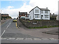
Photos of GL14 2RP


Area Information
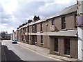
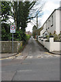
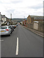
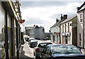
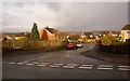
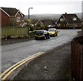
Living in GL14 2RP means being part of a compact, residential postcode area in England, covering 3,327 square metres and home to 2,091 residents. The population density of 621 people per square kilometre suggests a tightly knit community, where daily life is shaped by proximity to local amenities and a quiet, suburban rhythm. This area is distinct for its small-scale character, with housing stock primarily composed of individual homes rather than larger developments. The median age of 47 indicates a mature population, with the majority of residents falling between 30 and 64 years old. While the area lacks large urban features, its proximity to retail and transport options offers practical convenience. For those seeking a balance between seclusion and accessibility, GL14 2RP provides a foundation of stability, though its limited size means buyers may need to look beyond immediate surroundings for broader choices.
- Area Type
- Postcode
- Area Size
- 3327 m²
- Population
- 2091
- Population Density
- 621 people/km²
The property market in GL14 2RP is defined by its high home ownership rate of 62%, with houses making up the majority of the housing stock. This suggests a community where long-term residency is common, and properties are likely to be family homes rather than short-term rentals. The small area size means the housing stock is limited, which could make the local market competitive for buyers. Those seeking a home here may need to consider nearby areas for more options, as the immediate vicinity offers a confined selection. The predominance of houses over flats or apartments indicates a preference for private, standalone living, which may appeal to those prioritising space and independence. However, the lack of larger developments or commercial properties means the market remains niche.
House Prices in GL14 2RP
Showing 12 properties
| Address | Type | Beds | Baths | Last Sale Price | Last Sale Date | |
|---|---|---|---|---|---|---|
| 11 Commercial Street, Cinderford, GL14 2RP | Terraced | 2 | 1 | £138,250 | Feb 2025 | |
| 13 Commercial Street, Cinderford, GL14 2RP | Cottage | 2 | 1 | £146,000 | Feb 2022 | |
| 5 COMMERCIAL STREET, Cinderford, GL14 2RP | Flat | 2 | 1 | £169,500 | Aug 2007 | |
| 7 COMMERCIAL STREET, Cinderford, GL14 2RP | Flat | 1 | 1 | £137,000 | Aug 2007 | |
| The Ark, 15 Commercial Street, Cinderford, GL14 2RP | Terraced | - | - | £94,950 | Feb 2004 | |
| Milestone Care Home, 9 Commercial Street, Cinderford, GL14 2RP | hospital_care_home | - | - | £120,000 | Apr 2001 | |
| 11A Commercial Street, Cinderford, GL14 2RP | Cottage | 1 | 1 | - | - | |
| Flat, Soldiers And Sailors Club, 1 Commercial Street, Cinderford, GL14 2RP | Flat | - | - | - | - | |
| Flat 2, 7 Commercial Street, Cinderford, GL14 2RP | Flat | - | - | - | - | |
| Flat 2, 5 Commercial Street, Cinderford, GL14 2RP | Flat | - | - | - | - |
Energy Efficiency in GL14 2RP
The lifestyle in GL14 2RP is shaped by its proximity to retail and transport hubs. Local shops include Tesco Cinderford, Lidl Cinderford, and Co-op Valley, providing essential groceries and daily necessities. These stores cater to the community’s practical needs, reducing the need for long trips. The area’s transport options include the Dean Forest Railway and Parkend, which offer connections to nearby towns and services. While the data does not detail parks or leisure facilities, the presence of retail and transport amenities suggests a focus on convenience over expansive recreational spaces. For residents, this means a lifestyle that prioritises accessibility and simplicity, with amenities within walking or short driving distance.
Amenities
Schools
The nearest school to GL14 2RP is Steam Mills Primary School, which serves the area’s younger residents. Rated as ‘good’ by Ofsted, it provides a solid foundation for primary education. The absence of secondary schools in the data means families may need to look further afield for secondary education, which could be a consideration for those planning long-term stays. The presence of a primary school within practical reach is a positive for local families, offering convenience for daily routines. However, the lack of information on other educational institutions suggests that parents should investigate additional options beyond GL14 2RP itself.
| Rank | School | Type | Entry gender | Ages |
|---|
Explore more schools in this area
Go to Schools tabDemographics
The community in GL14 2RP is predominantly composed of adults aged 30 to 64, with a median age of 47. This suggests a population focused on established careers and family life, rather than younger or retired demographics. Home ownership is strong, with 62% of residents owning their homes, a figure that indicates a stable, long-term presence in the area. The accommodation type is largely houses, which aligns with the residential cluster’s character. The predominant ethnic group is White, reflecting a homogenous demographic profile. While no specific data on deprivation is provided, the high home ownership rate and moderate population density suggest a community with relatively stable economic conditions. However, the absence of detailed diversity metrics means the area’s social composition remains largely unexplored in the data.
Household Size
Accommodation Type
Tenure
Ethnic Group
Religion
Household Composition
Age
Household Deprivation
NS-SEC
Explore more demographic insights in this area
Go to Demographics tabPlanning
Planning Constraints
- Flood RiskPremium
- Ramsar Wetland SitesPremium
- Area of Outstanding Natural BeautyPremium
- Protected Nature ReservePremium
- Protected WoodlandPremium