Area Overview for GL14 2SD
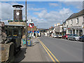
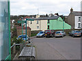
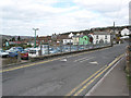
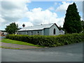
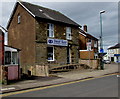
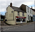
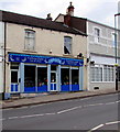
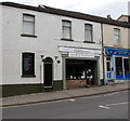
Photos of GL14 2SD


Area Information
Living in GL14 2SD means being part of a tightly knit residential cluster in England, where 2,091 people inhabit 940 square metres. The area’s compact size fosters a close-knit community, with a population density of 621 people per square kilometre. This postcode is ideal for those seeking a balance between urban convenience and a quieter, residential environment. Proximity to amenities like Lidl Cinderford, Tesco Cinderford, and Co-op Valley ensures daily essentials are within easy reach. The area’s appeal is further strengthened by its access to local transport options, including the Dean Forest Railway, which connects residents to nearby towns. While the community is small, it is well-served by a primary school with a good Ofsted rating, making it a practical choice for families. The mix of housing stock, predominantly owner-occupied homes, suggests a stable, long-term resident base. GL14 2SD is a place where practicality meets community, offering a straightforward lifestyle with minimal planning constraints.
- Area Type
- Postcode
- Area Size
- 940 m²
- Population
- 2091
- Population Density
- 621 people/km²
GL14 2SD is predominantly an owner-occupied area, with 62% of homes owned by residents rather than rented. The accommodation type is primarily houses, which is uncommon in many urban areas but typical of smaller, rural or semi-rural postcodes. This suggests a housing stock that is likely older, with a focus on single-family homes rather than flats or apartments. The small area size means the property market is limited in scale, with limited scope for new developments or rental opportunities. Buyers should consider the proximity to local amenities, such as schools and retail, which are critical for families. The high home ownership rate indicates a community with long-term residents, which may influence property values and market dynamics. For those seeking a home in GL14 2SD, the focus is on practicality, with houses offering space and stability in a compact, well-served area.
House Prices in GL14 2SD
No properties found in this postcode.
Energy Efficiency in GL14 2SD
Residents of GL14 2SD have access to a range of local amenities within practical reach. Retail options include Lidl Cinderford, Tesco Cinderford, and Co-op Valley, providing grocery and daily shopping convenience. The area’s proximity to the Dean Forest Railway and Parkend offers transport links to broader regional networks, though no motorways are listed. While the data does not mention parks or leisure facilities explicitly, the absence of planning constraints like AONB or protected woodlands suggests open spaces may be available nearby. The small size of GL14 2SD means amenities are compact but sufficient for daily life, with a focus on practicality. The community’s lifestyle is defined by accessibility to essentials, with limited scope for large-scale leisure or cultural facilities. This makes it suitable for those prioritising convenience over expansive recreational options.
Amenities
Schools
The nearest school to GL14 2SD is Steam Mills Primary School, which serves the area’s younger residents. Rated ‘good’ by Ofsted, it provides a reliable educational foundation for primary-aged children. The absence of secondary schools in the immediate vicinity means families may need to consider commuting to nearby towns for secondary education. However, the primary school’s quality and proximity make GL14 2SD a viable option for those prioritising early education. The school’s presence also contributes to the area’s community feel, acting as a focal point for local families. With no other schools listed in the data, the educational landscape is straightforward, focusing on primary needs. This simplicity may appeal to buyers seeking a quiet, family-friendly environment with essential services nearby.
| Rank | School | Type | Entry gender | Ages |
|---|
Explore more schools in this area
Go to Schools tabDemographics
The population of GL14 2SD skews towards adults aged 30–64, with a median age of 47. This indicates a community with a strong presence of middle-aged residents, likely including families and professionals. Home ownership is high at 62%, with houses being the predominant type of accommodation. The area’s demographic profile suggests a mature, established population, with limited data on younger or older age groups. The predominant ethnic group is White, reflecting a homogenous community. The population density of 621 people per square kilometre implies a mix of household types, though specific figures on family structures or lone occupancy are not provided. This density, combined with the high home ownership rate, suggests a stable, long-term resident base. The area’s characteristics align with a community prioritising stability over rapid change, with limited evidence of deprivation or transient populations.
Household Size
Accommodation Type
Tenure
Ethnic Group
Religion
Household Composition
Age
Household Deprivation
NS-SEC
Explore more demographic insights in this area
Go to Demographics tabPlanning
Planning Constraints
- Flood RiskPremium
- Ramsar Wetland SitesPremium
- Area of Outstanding Natural BeautyPremium
- Protected Nature ReservePremium
- Protected WoodlandPremium