Area Overview for GL14 2RA
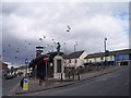
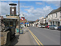
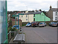
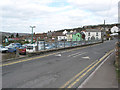
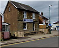
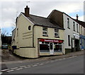
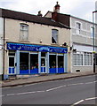
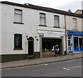
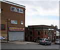
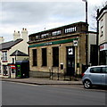
Photos of GL14 2RA


Area Information
GL14 2RA is a small residential postcode area in England, covering 6,223 square metres and home to 1,494 residents. Its population density of 240,063 people per square kilometre reflects a tightly packed community, typical of smaller urban clusters. This area is characterised by a mature demographic, with a median age of 47 and the majority of residents falling within the 30-64 age range. Daily life here is shaped by proximity to local amenities and a mix of housing stock. The area’s compact size means residents are likely within walking distance of shops, schools, and transport links. While it lacks large-scale infrastructure, its density supports a sense of community, with a focus on practical living. For buyers, GL14 2RA offers a snapshot of a stable, family-oriented environment, though its limited size means housing options are constrained. The area’s appeal lies in its balance of accessibility and quiet residential character, making it suitable for those prioritising convenience over expansive space.
- Area Type
- Postcode
- Area Size
- 6223 m²
- Population
- 1494
- Population Density
- 2821 people/km²
The property market in GL14 2RA is defined by a 58% home ownership rate, with houses making up the majority of accommodation types. This suggests a community where owner-occupation is common, though the area’s small size means the housing stock is limited. The focus on houses rather than flats or apartments indicates a preference for single-family homes, which may appeal to buyers seeking space and privacy. However, the compact nature of GL14 2RA means the available properties are likely concentrated within a narrow geographic footprint. For buyers, this could present challenges in finding multiple options, though the area’s proximity to amenities like schools and retail might offset this. The market is unlikely to be dominated by rental properties, given the high ownership rate, but the smaller number of homes could mean competition for available listings. Buyers should consider nearby areas for broader choices while recognising the value of GL14 2RA’s convenience.
House Prices in GL14 2RA
Showing 13 properties
| Address | Type | Beds | Baths | Last Sale Price | Last Sale Date | |
|---|---|---|---|---|---|---|
| 6-8 Woodgate Road, Cinderford, GL14 2RA | Semi-detached | 3 | 1 | £280,000 | Mar 2022 | |
| 5 Woodgate Road, Cinderford, GL14 2RA | Semi-detached | 3 | 1 | £174,000 | Jul 2018 | |
| 10 Woodgate Road, Cinderford, GL14 2RA | Semi-detached | 3 | 1 | £147,000 | Jul 2018 | |
| 3 Woodgate Road, Cinderford, GL14 2RA | Detached | 2 | 1 | £95,000 | Jul 2004 | |
| 14 Woodgate Road, Cinderford, GL14 2RA | Semi-detached | - | - | £60,000 | Dec 2002 | |
| 4 Woodgate Road, Cinderford, GL14 2RA | Detached | - | - | £45,000 | Dec 1996 | |
| 2 Woodgate Road, Cinderford, GL14 2RA | Detached | 4 | 1 | - | - | |
| Montclare House, Woodgate Road, Cinderford, GL14 2RA | Detached | - | - | - | - | |
| 7 Woodgate Road, Cinderford, GL14 2RA | Semi-detached | - | - | - | - | |
| 9 Woodgate Road, Cinderford, GL14 2RA | Semi-detached | - | - | - | - |
Energy Efficiency in GL14 2RA
The lifestyle in GL14 2RA is shaped by its proximity to essential amenities. Retail options include Lidl Cinderford, Tesco Cinderford, and Co-op Valley, providing access to groceries, household items, and everyday services. The Dean Forest Railway and Parkend offer transport links, though they are more practical for local travel than long-distance commuting. The area’s small size means residents can walk or cycle to these venues, fostering a sense of convenience. While there is no explicit mention of parks or leisure facilities in the data, the absence of protected natural areas like AONB or Ramsar sites suggests minimal constraints on development. The mix of retail and transport options supports a functional daily life, though the area may lack large-scale leisure or cultural venues. For those valuing accessibility over expansive recreational spaces, GL14 2RA offers a practical, community-focused environment.
Amenities
Schools
Residents of GL14 2RA have access to several primary schools, including Latimer County Junior School, Forest View Primary School (rated ‘good’ by Ofsted), and Heywood Community School. The SGS Forest High School, an academy, is also nearby but holds a ‘satisfactory’ Ofsted rating. The presence of multiple primary schools provides families with options for younger children, though the high school’s rating may raise concerns for parents prioritising academic performance. The mix of school types—primary and academy—suggests a range of educational approaches, from traditional to more specialised models. However, the absence of secondary schools within the immediate area might require students to commute. For families, the availability of local primary schools is a significant advantage, but the secondary education options warrant closer scrutiny. The overall school landscape reflects a balance of accessibility and variability in quality.
| Rank | School | Type | Entry gender | Ages |
|---|
Explore more schools in this area
Go to Schools tabDemographics
The community in GL14 2RA is predominantly composed of adults aged 30-64, with a median age of 47. This suggests a population skewed towards middle-aged individuals, likely including families and professionals. Home ownership rates stand at 58%, indicating a mix of owner-occupied properties and rental units. The accommodation type is primarily houses, reflecting a preference for single-family homes over flats. The predominant ethnic group is White, though specific data on diversity or deprivation levels is not provided. The age profile suggests a stable, established community with fewer young families or retirees compared to other areas. With 58% of residents owning their homes, the area may offer a sense of permanence, though the relatively high population density could imply shared resources or communal living spaces. This demographic profile aligns with a middle-income, family-focused environment where housing and local services are prioritised.
Household Size
Accommodation Type
Tenure
Ethnic Group
Religion
Household Composition
Age
Household Deprivation
NS-SEC
Explore more demographic insights in this area
Go to Demographics tabPlanning
Planning Constraints
- Flood RiskPremium
- Ramsar Wetland SitesPremium
- Area of Outstanding Natural BeautyPremium
- Protected Nature ReservePremium
- Protected WoodlandPremium