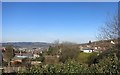
Area Overview for GL14 2SU
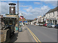
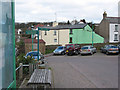
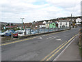
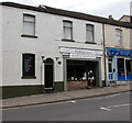
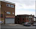
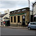
Photos of GL14 2SU

Area Information
Living in GL14 2SU offers a compact, residential experience within a small cluster of homes. The area covers 3,175 square metres and is home to 2,091 residents, giving it a population density of 621 people per square kilometre. This makes it a tight-knit community, where daily life is shaped by proximity to local amenities and a stable demographic. The median age of 47 suggests a mature population, with most residents falling in the 30-64 age range. This is a predominantly owner-occupied area, with 62% of homes owned by their occupants, and the majority of properties being houses rather than flats. The area’s small size means that most needs can be met locally, though its isolation from larger towns may require a car for broader access. For those seeking a quiet, established residential environment with a focus on home ownership, GL14 2SU provides a straightforward, low-maintenance living option.
- Area Type
- Postcode
- Area Size
- 3175 m²
- Population
- 2091
- Population Density
- 621 people/km²
The property market in GL14 2SU is characterised by a high rate of home ownership (62%) and a focus on houses rather than flats. This suggests a community where long-term residency is common, with properties likely to be family homes or multi-generational dwellings. The small size of the area means that the housing stock is limited, and buyers should consider the immediate surroundings for additional options. With no indication of rental properties in the data, this appears to be a market driven by owner-occupation rather than investment. The prevalence of houses may appeal to those seeking space and privacy, though the lack of newer developments could mean limited modern housing choices. For buyers, this area offers a straightforward, low-risk purchase, but competition for properties may be higher due to its compact nature.
House Prices in GL14 2SU
Showing 36 properties
| Address | Type | Beds | Baths | Last Sale Price | Last Sale Date | |
|---|---|---|---|---|---|---|
| 81A High Street, Cinderford, GL14 2SU | Terraced | 2 | 1 | £40,000 | Jun 2004 | |
| 81 High Street, Cinderford, GL14 2SU | house | - | - | £60,000 | Jun 2004 | |
| 57 High Street, Cinderford, GL14 2SU | Flat | - | - | £37,500 | Apr 2002 | |
| Flat 4, 55 High Street, Cinderford, GL14 2SU | Flat | 7 | 4 | - | - | |
| 63A High Street, Cinderford, GL14 2SU | Flat | 2 | 1 | - | - | |
| Bottom Flat, 59 High Street, Cinderford, GL14 2SU | Land | 2 | 2 | - | - | |
| Flat 3, 55 High Street, Cinderford, GL14 2SU | Flat | 7 | - | - | - | |
| 75A High Street, Cinderford, GL14 2SU | Flat | - | - | - | - | |
| 77C High Street, Cinderford, GL14 2SU | Flat | - | - | - | - | |
| Flat 1 Ground Floor, 65 High Street, Cinderford, GL14 2SU | Flat | - | - | - | - |
Energy Efficiency in GL14 2SU
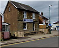
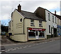
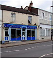
The lifestyle in GL14 2SU is shaped by its proximity to local retail and transport hubs. Within practical reach are Lidl Cinderford, Tesco Cinderford, and Co-op Valley, providing everyday shopping needs. The Dean Forest Railway and Parkend offer transport links, though the area lacks larger leisure or entertainment venues. This means that residents may need to travel to nearby towns for dining, cultural activities, or more extensive shopping. The presence of multiple retail outlets suggests a practical, no-frills approach to daily life, with convenience prioritised over luxury. The area’s small size means that community interactions are likely to be frequent, fostering a sense of local cohesion. While there are no named parks or recreational spaces in the data, the nearby amenities imply a focus on functional living rather than expansive leisure opportunities.
Amenities
Schools
The nearest school to GL14 2SU is Steam Mills Primary School, which serves the local community with a good Ofsted rating. This primary school is a key asset for families, offering a reliable educational foundation for younger children. However, the data does not list secondary schools or other educational institutions, which may require residents to travel further for secondary education. The presence of a primary school with a good rating suggests that the area is suitable for families with young children, though parents should investigate the availability of secondary schools in nearby towns. The single school listed indicates that the community’s educational needs are partially met locally, but additional research may be necessary for comprehensive planning.
| Rank | School | Type | Entry gender | Ages |
|---|
Explore more schools in this area
Go to Schools tabDemographics
The population of GL14 2SU is predominantly adults aged 30-64, with a median age of 47. This suggests a community of middle-aged residents, many of whom may be in their prime working years or nearing retirement. Home ownership is high at 62%, indicating a stable, long-term resident base rather than a transient rental market. The area is composed mainly of houses, which aligns with the demographic profile of older, family-oriented households. The predominant ethnic group is White, though specific data on diversity or deprivation is not provided. The population density of 621 people per square kilometre reflects a moderately sized community, where social interactions are likely to be frequent and localised. This profile points to a place where residents value stability, with fewer pressures from high population growth or shifting demographics.
Household Size
Accommodation Type
Tenure
Ethnic Group
Religion
Household Composition
Age
Household Deprivation
NS-SEC
Explore more demographic insights in this area
Go to Demographics tabPlanning
Planning Constraints
- Flood RiskPremium
- Ramsar Wetland SitesPremium
- Area of Outstanding Natural BeautyPremium
- Protected Nature ReservePremium
- Protected WoodlandPremium