Area Overview for GL14 2RE
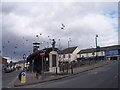
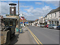
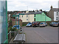
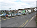
Photos of GL14 2RE
Area Information
Living in GL14 2RE means inhabiting a compact, densely populated residential cluster in England. The area covers just 7,324 square metres, yet it accommodates 1,494 residents, resulting in a population density of 203,991 people per square kilometre. This high density suggests a tightly knit community, though the small size means the area is likely to feel more like a cluster of homes than a sprawling suburb. Daily life here is shaped by its proximity to amenities and services, with local shops and transport links within practical reach. The area’s character is defined by its mix of residential properties and the presence of nearby schools, which cater to families. While the population is relatively small, the density implies a focus on community interaction, though the lack of significant green spaces or planning constraints suggests a pragmatic, urban-style living environment. For those seeking a quiet, close-knit neighbourhood with easy access to essentials, GL14 2RE offers a compact alternative to larger towns. However, its limited size means residents may need to venture further for broader leisure or commercial opportunities.
- Area Type
- Postcode
- Area Size
- 7324 m²
- Population
- 1494
- Population Density
- 2821 people/km²
The property market in GL14 2RE is characterised by a high proportion of owner-occupied homes, with 58% of residents owning their properties. This suggests a stable market where long-term investment is more common than rental speculation. The accommodation type is predominantly houses, which is unusual for a small postcode area and may indicate a focus on family homes rather than apartments or terraced housing. Given the area’s compact size, the housing stock is likely limited, with fewer new developments or speculative builds. For buyers, this means a smaller pool of properties to choose from, though the emphasis on owner-occupation may mean properties are less likely to be on the market. The predominance of houses also implies that the area is not suited to those seeking high-density living or rental opportunities. Buyers should consider the limited availability and the potential for a slower-moving market.
House Prices in GL14 2RE
Showing 11 properties
| Address | Type | Beds | Baths | Last Sale Price | Last Sale Date | |
|---|---|---|---|---|---|---|
| 3 Trinity Way, Cinderford, GL14 2RE | Semi-detached | 2 | 1 | £125,000 | Sep 2024 | |
| 15 Trinity Way, Cinderford, GL14 2RE | Detached | - | - | £118,000 | Mar 2009 | |
| 11 Trinity Way, Cinderford, GL14 2RE | Detached | 3 | 1 | £184,500 | Nov 2004 | |
| 13 Trinity Way, Cinderford, GL14 2RE | Detached | 2 | 1 | £15,000 | Jul 2003 | |
| 5 Trinity Way, Cinderford, GL14 2RE | Cottage | 3 | 1 | - | - | |
| 7 Trinity Way, Cinderford, GL14 2RE | Detached | 3 | - | - | - | |
| 1 Trinity Way, Cinderford, GL14 2RE | Semi-detached | 2 | 1 | - | - | |
| 15C Trinity Way, Cinderford, GL14 2RE | Bungalow | - | - | - | - | |
| 15B Trinity Way, Cinderford, GL14 2RE | Bungalow | - | - | - | - | |
| 15A Trinity Way, Cinderford, GL14 2RE | Bungalow | - | - | - | - |
Energy Efficiency in GL14 2RE
The lifestyle in GL14 2RE is shaped by its proximity to retail and transport hubs. Local shops like Lidl Cinderford, Tesco Cinderford, and Co-op Valley provide everyday essentials, reducing the need for long trips to larger towns. The Dean Forest Railway and Parkend offer connections to nearby areas, enhancing accessibility for commuters and leisure travel. While the data does not specify parks or leisure facilities, the area’s small size suggests limited green spaces. The presence of multiple schools and retail options indicates a focus on practical living rather than expansive recreational opportunities. For residents, this means a convenient, compact lifestyle with immediate access to necessities, though those prioritising extensive leisure or natural environments may need to look further afield. The character of the area is defined by its functionality and proximity to services, making it suitable for those who value ease of access over expansive amenities.
Amenities
Schools
Residents of GL14 2RE have access to several schools within practical reach. Primary education is provided by Latimer County Junior School, Forest View Primary School, and Heywood Community School, all of which cater to younger children. Forest View Primary School has an Ofsted rating of ‘good’, while the others are not rated in the data. For secondary education, SGS Forest High School is an academy with an Ofsted rating of ‘satisfactory’. The presence of multiple primary schools suggests a focus on early education, though the secondary option is limited to one institution. The mix of school types—primarily primary with one academy—means families may need to consider travel for secondary schooling. The ratings indicate a generally acceptable standard, though the ‘satisfactory’ rating for the high school may raise questions about its performance compared to other schools in the region.
| Rank | School | Type | Entry gender | Ages |
|---|
Explore more schools in this area
Go to Schools tabDemographics
The community in GL14 2RE is predominantly middle-aged, with a median age of 47 and the largest age group being adults aged 30–64. This suggests a population that is largely settled, with fewer young families or elderly residents. Home ownership is strong, with 58% of residents owning their homes, indicating a stable, long-term demographic. The accommodation type is primarily houses, which contrasts with areas dominated by flats or apartments. The predominant ethnic group is White, reflecting a homogenous population. The absence of specific data on deprivation or diversity means the area’s social dynamics remain less defined in the provided information. However, the high home ownership rate and age profile suggest a community focused on stability rather than rapid change. For prospective buyers, this demographic profile may indicate a low turnover of properties and a preference for long-term residency.
Household Size
Accommodation Type
Tenure
Ethnic Group
Religion
Household Composition
Age
Household Deprivation
NS-SEC
Explore more demographic insights in this area
Go to Demographics tabPlanning
Planning Constraints
- Flood RiskPremium
- Ramsar Wetland SitesPremium
- Area of Outstanding Natural BeautyPremium
- Protected Nature ReservePremium
- Protected WoodlandPremium