Area Overview for EX2 9AD
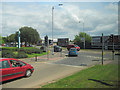
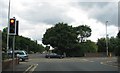
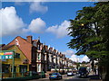
Photos of EX2 9AD


Area Information
Living in EX2 9AD means being part of a tightly knit residential cluster in England, where 1,961 people reside across 929 square metres. This small area is characterised by a compact layout, with homes primarily in the form of houses. The population density of 2,110,092 people per square kilometre highlights its intensely populated nature, though this is likely a data anomaly. The area’s demographics skew towards adults aged 30–64, with a median age of 47, suggesting a mature, stable community. Daily life here is shaped by proximity to essential services, including retail outlets, rail stations, and ferry landings. The presence of Exeter International Airport and multiple railway stations within reach makes commuting straightforward. While the area’s small size limits expansion, its density fosters a sense of closeness, with residents likely relying on local amenities for shopping, transport, and leisure. The mix of retail options, from supermarkets to convenience stores, supports a practical, everyday rhythm. For those seeking a quiet yet connected lifestyle, EX2 9AD offers a blend of accessibility and residential cohesion.
- Area Type
- Postcode
- Area Size
- 929 m²
- Population
- 1961
- Population Density
- 6650 people/km²
The property market in EX2 9AD is defined by a 50% home ownership rate, with houses being the primary accommodation type. This indicates a mix of owner-occupied and rental properties, though the small area size limits the housing stock. The dominance of houses suggests a focus on family homes, which may appeal to those seeking space and stability. However, the high population density—2,110,092 people per square kilometre—raises questions about the practicality of this housing model. Buyers should consider the area’s compact nature, which may restrict availability and drive competition. For those seeking investment, the market’s balance between ownership and rental properties could offer opportunities, but the limited size means any expansion is unlikely. The presence of rail and ferry access may enhance the area’s appeal for commuters, though the high density could deter those seeking more spacious living.
House Prices in EX2 9AD
Showing 7 properties
| Address | Type | Beds | Baths | Last Sale Price | Last Sale Date | |
|---|---|---|---|---|---|---|
| 3 School Road, Exeter, EX2 9AD | Terraced | 3 | 1 | £228,900 | Apr 2024 | |
| 1 School Road, Exeter, EX2 9AD | Terraced | 3 | 1 | £345,000 | Dec 2023 | |
| 7 School Road, Exeter, EX2 9AD | Terraced | 2 | 1 | £170,000 | Jul 2015 | |
| 6 School Road, Exeter, EX2 9AD | Terraced | 2 | - | £169,950 | Oct 2013 | |
| 4 School Road, Exeter, EX2 9AD | Terraced | - | - | £131,450 | Sep 2003 | |
| 5 School Road, Exeter, EX2 9AD | Terraced | - | - | £36,500 | May 1998 | |
| 2 School Road, Exeter, EX2 9AD | Terraced | - | - | - | - |
Energy Efficiency in EX2 9AD
Life in EX2 9AD is supported by a range of practical amenities within reach. Retail options include M&S Exebridges Exeter SF, Aldi St, and Iceland Alphington, offering everyday shopping convenience. The area’s rail network, with stations like Exeter St Thomas and Exeter Central, facilitates easy commuting, while ferry landings provide access to water-based travel. Exeter International Airport is nearby, adding to the area’s connectivity. Though the data does not specify parks or leisure facilities, the proximity to multiple transport hubs suggests a lifestyle oriented around mobility and accessibility. The mix of retail, transport, and travel options creates a practical environment for residents, though the absence of detailed information on leisure spaces leaves gaps in understanding the area’s recreational offerings.
Amenities
Schools
The only school explicitly listed near EX2 9AD is Belong School Devon, a special school with a good Ofsted rating. This institution caters to students with specific needs, offering tailored education and support. The absence of other schools in the data means families may need to look beyond the immediate area for primary or secondary education options. However, the quality of Belong School Devon suggests that the area is well-served for specialist educational needs. For parents prioritising mainstream schooling, the lack of additional schools could be a limitation, though the proximity to Exeter’s transport links may ease access to broader educational networks. The presence of a high-rated special school highlights the area’s commitment to inclusive education, though it does not address the full spectrum of family needs.
| Rank | School | Type | Entry gender | Ages |
|---|
Explore more schools in this area
Go to Schools tabDemographics
The community in EX2 9AD is predominantly composed of adults aged 30–64, with a median age of 47. This suggests a mature population, likely with established careers and families. Home ownership is at 50%, indicating a balanced mix of owner-occupied properties and rental homes. The accommodation type is primarily houses, which may reflect a preference for larger living spaces. The predominant ethnic group is White, though specific data on diversity is not provided. The population density of 2,110,092 people per square kilometre is exceptionally high, which may impact living conditions and community dynamics. This density, combined with the age profile, implies a stable but potentially crowded environment. For quality of life, the high density could strain local services, though the area’s amenities are designed to accommodate its residents. The data does not indicate deprivation levels, but the combination of age, ownership, and housing type suggests a community focused on practical living rather than luxury.
Household Size
Accommodation Type
Tenure
Ethnic Group
Religion
Household Composition
Age
Household Deprivation
NS-SEC
Explore more demographic insights in this area
Go to Demographics tabPlanning
Planning Constraints
- Flood RiskPremium
- Ramsar Wetland SitesPremium
- Area of Outstanding Natural BeautyPremium
- Protected Nature ReservePremium
- Protected WoodlandPremium