Area Overview for EX2 9AF
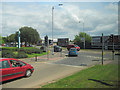
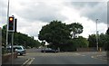
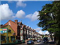
Photos of EX2 9AF


Area Information
Living in EX2 9AF means being part of a tightly packed residential cluster in England, where 1,555 people reside across just 3,486 square metres. This high population density creates a compact, possibly close-knit community, though the area’s small size means every resident is within walking distance of key services. The median age of 47 suggests a mature demographic, with adults aged 30–64 forming the largest group. Proximity to Exeter’s rail network, including Exeter St Thomas and Exeter Central stations, offers easy access to the city’s amenities. Nearby, St Thomas Primary School provides a local education hub, while broadband connectivity scores 93 out of 100, ensuring reliable internet. However, the area’s critical flood risk is a significant concern, with high water coverage posing challenges for property owners. Despite this, the low crime score of 80 indicates a generally safe environment. For those seeking a mix of practicality and accessibility, EX2 9AF offers a compact, service-rich setting, though its environmental risks must be weighed carefully.
- Area Type
- Postcode
- Area Size
- 3486 m²
- Population
- 1555
- Population Density
- 7578 people/km²
The property market in EX2 9AF is characterised by a 58% home ownership rate, with houses forming the majority of accommodation. This suggests a mix of owner-occupied properties and rental units, though the exact proportion of rentals is not specified. Given the area’s small size and high population density, housing options are likely limited to smaller, family-friendly homes. The predominance of houses over flats or apartments may appeal to those seeking traditional, private living spaces. However, the compact nature of the area means buyers must consider proximity to neighbours and shared infrastructure. For those prioritising location over space, EX2 9AF’s proximity to Exeter’s rail network and amenities could outweigh its limitations. Potential buyers should also note the critical flood risk, which may impact property value and insurance costs.
House Prices in EX2 9AF
Showing 15 properties
| Address | Type | Beds | Baths | Last Sale Price | Last Sale Date | |
|---|---|---|---|---|---|---|
| 21 School Road, Exeter, EX2 9AF | Terraced | 3 | 1 | £255,000 | Dec 2023 | |
| 30 School Road, Exeter, EX2 9AF | house | - | - | £357,500 | Jul 2018 | |
| 22 School Road, Exeter, EX2 9AF | Terraced | 2 | 1 | £195,000 | Sep 2017 | |
| 19 School Road, Exeter, EX2 9AF | Terraced | 3 | 1 | £195,500 | May 2015 | |
| 18 School Road, Exeter, EX2 9AF | Terraced | 3 | 1 | £190,000 | Mar 2015 | |
| 16 School Road, Exeter, EX2 9AF | Terraced | 3 | 1 | £163,000 | Jul 2012 | |
| 29 School Road, Exeter, EX2 9AF | Terraced | - | - | £250,000 | Jan 2008 | |
| 28 School Road, Exeter, EX2 9AF | Semi-detached | - | - | £240,000 | Aug 2007 | |
| 27 School Road, Exeter, EX2 9AF | Detached | - | - | £230,000 | Apr 2006 | |
| 25 School Road, Exeter, EX2 9AF | Terraced | 3 | 1 | £54,000 | Apr 1998 |
Energy Efficiency in EX2 9AF
Life in EX2 9AF is shaped by its proximity to retail, transport, and travel hubs. Local shops include Aldi St, Iceland Alphington, and M&S Exebridges Exeter SF, providing everyday essentials. The area’s rail network, with multiple stations, ensures easy access to Exeter’s city centre, where more shops, dining, and services are available. Ferry landings near Topsham and Turf Lock Inn offer scenic travel options, while Exeter International Airport is a short journey away for regional and international flights. Though the area itself is small, its connectivity to Exeter means residents can enjoy the city’s cultural and leisure offerings. The compact nature of the area may limit local parks or green spaces, but the surrounding region likely provides recreational opportunities. For those valuing convenience and accessibility, EX2 9AF offers a practical, well-connected lifestyle.
Amenities
Schools
The nearest school to EX2 9AF is St Thomas Primary School, which serves the area with a primary education offering. The school holds a ‘good’ Ofsted rating, indicating a reliable standard of teaching and facilities. As the only educational institution listed, it is the primary option for families with young children. The absence of secondary schools nearby means parents may need to consider commuting for older children, though Exeter’s city centre is within easy reach via rail. The presence of a well-rated primary school is a key draw for families, ensuring a foundation of quality education. However, the lack of further schooling options within the immediate vicinity is a factor to consider for long-term family planning.
| Rank | School | Type | Entry gender | Ages |
|---|
Explore more schools in this area
Go to Schools tabDemographics
EX2 9AF’s population of 1,555 is concentrated in a small area, resulting in a density of 446,028 people per square kilometre—a figure that underscores the area’s intensity. The median age of 47 reflects a community skewed towards middle-aged adults, with 30–64-year-olds making up the largest age group. Home ownership stands at 58%, with houses being the primary accommodation type. This suggests a stable, family-oriented demographic, though the high density may contribute to a lack of spacious living. The predominant ethnic group is White, and while no specific deprivation data is provided, the high population density and limited land area could indicate pressure on housing and public services. For residents, this means a tightly woven community where proximity to amenities is a strength, but space constraints may limit personal living quarters.
Household Size
Accommodation Type
Tenure
Ethnic Group
Religion
Household Composition
Age
Household Deprivation
NS-SEC
Explore more demographic insights in this area
Go to Demographics tabPlanning
Planning Constraints
- Flood RiskPremium
- Ramsar Wetland SitesPremium
- Area of Outstanding Natural BeautyPremium
- Protected Nature ReservePremium
- Protected WoodlandPremium