Area Overview for EX2 9AA
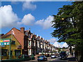
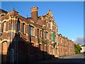
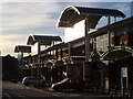
Photos of EX2 9AA


Area Information
Living in EX2 9AA means inhabiting a tightly packed residential cluster in England, where 1,555 people reside across just 3,617 square metres. The area’s high population density—429,902 people per square kilometre—reflects its compact nature, typical of small postcode areas. This is a community defined by proximity, with homes clustered closely together. Daily life here is shaped by the surrounding infrastructure: nearby rail stations, ferry landings, and a regional airport provide connectivity, while local shops and schools offer convenience. The area’s small size means amenities are within easy reach, though its density may feel intense for those accustomed to more spacious settings. EX2 9AA is not a sprawling suburb but a focused, self-contained neighbourhood, ideal for those prioritising accessibility over open space. The presence of St Thomas Primary School, with its ‘good’ Ofsted rating, adds to the area’s appeal for families. While the population is predominantly White and skewed toward adults aged 30–64, the community’s character is defined by its practicality and proximity to transport hubs.
- Area Type
- Postcode
- Area Size
- 3617 m²
- Population
- 1555
- Population Density
- 7578 people/km²
The property market in EX2 9AA is defined by its high home ownership rate of 58%, suggesting a balance between owner-occupied homes and rental properties. The accommodation type is predominantly houses, which is unusual in a small, high-density area. This implies that properties here are likely to be family homes, possibly with gardens or larger living spaces, despite the limited area. The compact nature of EX2 9AA means the housing stock is finite, and buyers should consider the limited availability of properties in this specific postcode. The focus on houses rather than flats or apartments may appeal to those seeking more space, though the area’s size restricts expansion. For buyers, this means competition could be fierce, and the market may lean toward established homeowners rather than first-time buyers. The proximity to transport links and amenities may enhance the area’s desirability, but the small footprint means any development is constrained.
House Prices in EX2 9AA
Showing 18 properties
| Address | Type | Beds | Baths | Last Sale Price | Last Sale Date | |
|---|---|---|---|---|---|---|
| 54 Beaufort Road, Exeter, EX2 9AA | Terraced | 2 | 1 | £245,000 | Aug 2025 | |
| 60 Beaufort Road, Exeter, EX2 9AA | Terraced | 2 | 1 | £248,000 | Jul 2022 | |
| 63 Beaufort Road, Exeter, EX2 9AA | house | - | - | £235,000 | Dec 2021 | |
| 57 Beaufort Road, Exeter, EX2 9AA | Terraced | 3 | 1 | £200,000 | Aug 2020 | |
| 52 Beaufort Road, Exeter, EX2 9AA | house | - | - | £191,000 | Jul 2019 | |
| 59 Beaufort Road, Exeter, EX2 9AA | Terraced | 3 | 1 | £240,000 | Apr 2019 | |
| 55 Beaufort Road, Exeter, EX2 9AA | Terraced | 3 | - | £180,000 | May 2016 | |
| 3, Beaufort Court, Beaufort Road, Exeter, EX2 9AA | Flat | - | - | £99,000 | Oct 2015 | |
| 2, Beaufort Court, Beaufort Road, Exeter, EX2 9AA | Flat | 2 | 1 | £122,000 | Dec 2011 | |
| 56 Beaufort Road, Exeter, EX2 9AA | Terraced | - | - | £158,000 | Mar 2007 |
Energy Efficiency in EX2 9AA
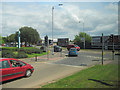
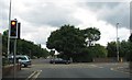
Life in EX2 9AA is characterised by proximity to practical amenities. The area has five retail outlets, including Aldi St and Iceland Alphington, offering everyday shopping convenience. Nearby rail stations—Exeter St Thomas, Exeter Central, and Marsh Barton—provide easy access to commuting routes, while ferry landings like Topsham Lock Ferry Landing add alternative transport options. The presence of Exeter International Airport ensures regional and international travel is within reach. For leisure, the area’s compact size means amenities are clustered closely, reducing the need for long commutes. The mix of retail, transport, and travel options supports a lifestyle that balances practicality with accessibility. While the data does not mention parks or leisure facilities directly, the proximity to rail and ferry services suggests opportunities for outdoor activities beyond the immediate postcode. The area’s focus on connectivity and convenience makes it appealing for those prioritising ease of access over expansive green spaces.
Amenities
Schools
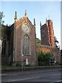
The primary school nearest to EX2 9AA is St Thomas Primary School, which holds a ‘good’ Ofsted rating. This school serves the local community, offering education for younger children in the area. The absence of secondary schools in the data means families may need to look further afield for high school options, though the primary school’s rating suggests a reliable foundation for early education. The presence of a single primary school with a positive rating indicates that the area is well-served for primary education but may lack the diversity of school types that some families seek. For parents prioritising a strong start to their children’s schooling, St Thomas Primary School’s performance is a key consideration. The data does not include information on other educational institutions, so further research may be necessary for secondary schooling.
| Rank | School | Type | Entry gender | Ages |
|---|
Explore more schools in this area
Go to Schools tabDemographics
The demographic profile of EX2 9AA is marked by a median age of 47, with the majority of residents falling into the 30–64 age bracket. This suggests a mature, stable population, likely with established careers and family ties. Home ownership rates stand at 58%, indicating a mix of owner-occupied properties and rental units. The accommodation type is predominantly houses, which is notable in a high-density area, suggesting a focus on single-family living rather than flats or apartments. The predominant ethnic group is White, though no specific data on diversity or deprivation is provided. The age distribution implies a community with a strong presence of middle-aged individuals, potentially with children in local schools. The absence of detailed diversity metrics means the area’s social composition remains largely uncharacterised beyond these figures. The high proportion of adult residents may reflect a lack of student housing or a focus on family-oriented living, though this is not explicitly confirmed by the data.
Household Size
Accommodation Type
Tenure
Ethnic Group
Religion
Household Composition
Age
Household Deprivation
NS-SEC
Explore more demographic insights in this area
Go to Demographics tabPlanning
Planning Constraints
- Flood RiskPremium
- Ramsar Wetland SitesPremium
- Area of Outstanding Natural BeautyPremium
- Protected Nature ReservePremium
- Protected WoodlandPremium