Area Overview for EX2 8HH
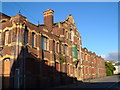
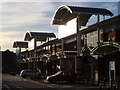
Photos of EX2 8HH


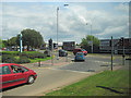
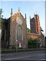
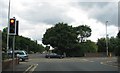


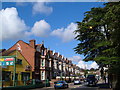

Area Information
Living in EX2 8HH means inhabiting a small, tightly packed residential cluster in England’s southwest, where the population of 1,555 is spread over just 5,737 square metres. This creates a high population density of 271,048 people per square kilometre, reflecting a compact, possibly urbanised layout. The area’s proximity to Exeter and its surrounding infrastructure suggests it is well integrated into regional networks. Daily life here is likely shaped by the presence of nearby schools, rail stations, and retail hubs. The demographic profile—predominantly adults aged 30–64, with a median age of 47—hints at a mature, stable community, possibly with families seeking established housing. The area’s small size and high density may foster a close-knit environment, though it also means limited space for expansion. Residents benefit from proximity to transport links, including multiple railway stations and ferry landings, which could enhance connectivity for commuting or leisure. However, the area’s high flood risk, as noted in assessments, is a critical factor to consider for long-term living.
- Area Type
- Postcode
- Area Size
- 5737 m²
- Population
- 1555
- Population Density
- 7578 people/km²
The property market in EX2 8HH is characterised by a 58% home ownership rate, with houses being the predominant accommodation type. This suggests a focus on owner-occupied housing rather than a rental market, though the exact number of rental properties is unspecified. The small area size—just 5,737 square metres—implies a limited housing stock, which could make the market competitive for buyers. The concentration of houses may appeal to families seeking larger living spaces, but the compact nature of the area could restrict availability. Proximity to amenities like schools, rail stations, and retail hubs may enhance the area’s desirability, though buyers should consider the high flood risk and limited space for expansion. For those prioritising convenience and established infrastructure, EX2 8HH’s properties could offer a practical option, though the small size may limit long-term growth potential.
House Prices in EX2 8HH
Showing 10 properties
| Address | Type | Beds | Baths | Last Sale Price | Last Sale Date | |
|---|---|---|---|---|---|---|
| 12 Alphington Road, Exeter, EX2 8HH | Terraced | 2 | 1 | £277,627 | Jun 2023 | |
| 8 Alphington Road, Exeter, EX2 8HH | Semi-detached | 5 | 2 | £475,000 | Apr 2023 | |
| 20 Alphington Road, Exeter, EX2 8HH | Detached | - | - | £625,000 | Feb 2007 | |
| 16 Alphington Road, Exeter, EX2 8HH | Detached | - | - | £145,000 | Jun 1999 | |
| Flat 1, 8 Alphington Road, Exeter, EX2 8HH | Flat | - | - | - | - | |
| Flat 2, 8 Alphington Road, Exeter, EX2 8HH | Flat | - | - | - | - | |
| 6 Alphington Road, Exeter, EX2 8HH | Semi-detached | - | - | - | - | |
| 14 Alphington Road, Exeter, EX2 8HH | house | - | - | - | - | |
| 10 Alphington Road, Exeter, EX2 8HH | Detached | - | - | - | - | |
| Le Roy Funeral Service, 10 Alphington Road, Exeter, EX2 8HH | general_industrial | - | - | - | - |
Energy Efficiency in EX2 8HH
The lifestyle in EX2 8HH is shaped by its proximity to a range of amenities. Retail options include Aldi St, Iceland Alphington, and M&S Exebridges Exeter SF, offering everyday shopping needs. The area’s rail network, with stations like Exeter St Thomas and Marsh Barton, provides easy access to urban centres and beyond. Ferry landings such as Topsham Lock and Turf Lock Inn add a unique dimension for those preferring water-based travel. The presence of Exeter International Airport further expands connectivity. While the data does not mention parks or leisure facilities, the density of retail and transport options suggests a focus on practicality over expansive green spaces. Residents likely enjoy a mix of convenience and regional integration, though the small area size may limit opportunities for larger-scale leisure activities.
Amenities
Schools
The nearest school to EX2 8HH is St Thomas Primary School, which serves the area’s primary education needs. The school is listed twice in the data, both times with a ‘good’ Ofsted rating, though this may indicate a duplication rather than two separate institutions. As a primary school, it caters to younger children, which is crucial for families with dependents. The absence of secondary schools in the data means residents may need to travel further for secondary education, but the proximity of St Thomas Primary suggests a focus on early years education. The ‘good’ rating indicates a reliable, well-performing institution, which is a key consideration for parents evaluating the area’s suitability for raising children.
| Rank | School | Type | Entry gender | Ages |
|---|
Explore more schools in this area
Go to Schools tabDemographics
The community in EX2 8HH is predominantly composed of adults aged 30–64, with a median age of 47, indicating a mature population. Home ownership stands at 58%, suggesting a mix of owner-occupied properties and rentals, though the exact proportion of renters is not specified. The accommodation type is primarily houses, which may reflect a preference for family homes over flats. The predominant ethnic group is White, with no data provided on other ethnicities or diversity metrics. The age profile and home ownership rate imply a stable, possibly middle-aged population with established careers and families. The absence of specific data on deprivation or income levels means it is unclear whether the area faces socioeconomic challenges, though the high population density and small size might suggest limited resources or space for community amenities.
Household Size
Accommodation Type
Tenure
Ethnic Group
Religion
Household Composition
Age
Household Deprivation
NS-SEC
Explore more demographic insights in this area
Go to Demographics tabPlanning
Planning Constraints
- Flood RiskPremium
- Ramsar Wetland SitesPremium
- Area of Outstanding Natural BeautyPremium
- Protected Nature ReservePremium
- Protected WoodlandPremium