Area Overview for EX2 8HW
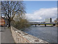
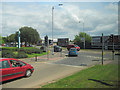
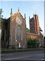
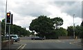
Photos of EX2 8HW


Area Information
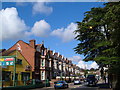
Living in EX2 8HW means being part of a tightly knit residential cluster in England, where 1,555 people reside across just 1,889 square metres. This high population density creates a compact, community-focused environment, with homes primarily in private ownership. The area’s character is defined by its proximity to essential services and transport links, making it practical for daily life. Residents benefit from nearby rail stations, including Exeter St Thomas and Exeter Central, which connect to broader networks. The presence of St Thomas Primary School, rated good by Ofsted, adds to the appeal for families. While the area is small, it offers a blend of convenience and accessibility, with shops, ferry landings, and an airport within reach. However, the high flood risk score of 100 underscores the need for careful consideration of property location. For those seeking a compact, well-served neighbourhood with a focus on practicality, EX2 8HW provides a distinct mix of residential density and connectivity.
- Area Type
- Postcode
- Area Size
- 1889 m²
- Population
- 1555
- Population Density
- 7578 people/km²
The property market in EX2 8HW is dominated by owner-occupied homes, with 58% of properties in private hands. This suggests a relatively stable market, though the small area size means the housing stock is limited. The accommodation type is primarily houses, which may indicate a focus on family homes rather than apartments or flats. For buyers, this could mean a niche market with limited options, but properties here may benefit from proximity to amenities such as rail stations, schools, and retail. The high population density may also mean that properties are in demand, particularly for those prioritising convenience. However, potential buyers should consider the area’s flood risk, which could impact long-term value and insurance costs. The market is likely to cater to those seeking a compact, well-served home with access to essential services.
House Prices in EX2 8HW
Showing 15 properties
| Address | Type | Beds | Baths | Last Sale Price | Last Sale Date | |
|---|---|---|---|---|---|---|
| 4, Fairfield Mansions, Alphington Road, Exeter, EX2 8HW | Flat | 1 | 1 | £152,000 | May 2025 | |
| 14, Fairfield Mansions, Alphington Road, Exeter, EX2 8HW | Maisonette | - | - | £225,000 | Nov 2023 | |
| 8, Fairfield Mansions, Alphington Road, Exeter, EX2 8HW | Flat | - | - | £170,000 | Sep 2021 | |
| 7, Fairfield Mansions, Alphington Road, Exeter, EX2 8HW | Semi-detached | 3 | - | £225,000 | Mar 2021 | |
| 13, Fairfield Mansions, Alphington Road, Exeter, EX2 8HW | Flat | 1 | 1 | £165,000 | Nov 2020 | |
| 10, Fairfield Mansions, Alphington Road, Exeter, EX2 8HW | Flat | 2 | 1 | £155,000 | Jun 2020 | |
| 12, Fairfield Mansions, Alphington Road, Exeter, EX2 8HW | Flat | 1 | 1 | £156,000 | Dec 2019 | |
| 6, Fairfield Mansions, Alphington Road, Exeter, EX2 8HW | Semi-detached | 2 | 1 | £214,500 | Feb 2018 | |
| 9, Fairfield Mansions, Alphington Road, Exeter, EX2 8HW | Flat | 1 | 1 | £143,500 | May 2015 | |
| 5, Fairfield Mansions, Alphington Road, Exeter, EX2 8HW | Semi-detached | 1 | 1 | £210,000 | Apr 2015 |
Energy Efficiency in EX2 8HW
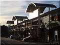
Residents of EX2 8HW have access to a range of amenities within practical reach, including retail options like Aldi St, Iceland Alphington, and M&S Exebridges Exeter SF. These shops provide everyday essentials, contributing to a convenient lifestyle. The area’s proximity to rail stations, such as Exeter St Thomas and Exeter Central, ensures easy access to public transport, while ferry landings like Topsham Lock Ferry Landing offer alternative routes. Exeter International Airport is also nearby, catering to travel needs. Though the data does not mention parks or leisure facilities, the presence of multiple transport options and retail outlets suggests a lifestyle focused on accessibility and practicality. For those valuing ease of movement and proximity to services, EX2 8HW offers a functional, well-connected environment.
Amenities
Schools
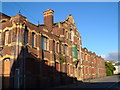
The nearest school to EX2 8HW is St Thomas Primary School, a primary institution with an Ofsted rating of good. This school serves the local community, offering education for younger children in a setting that meets quality standards. The presence of a primary school within practical reach is a key factor for families considering the area, as it reduces the need for long commutes. However, no secondary schools are listed in the data, so families may need to look beyond EX2 8HW for comprehensive schooling. The good Ofsted rating indicates a reliable educational environment, though prospective buyers should verify whether the school’s capacity aligns with local demand. For those prioritising proximity to education, St Thomas Primary School is a notable asset of the area.
| Rank | School | Type | Entry gender | Ages |
|---|
Explore more schools in this area
Go to Schools tabDemographics
The population of EX2 8HW is predominantly adults aged 30–64, with a median age of 47. This suggests a mature, stable community, likely with established households. Home ownership stands at 58%, indicating a mix of owner-occupied properties and rentals, though the exact balance of rental stock is not specified. The accommodation type is primarily houses, which may reflect a preference for family homes in this small area. The predominant ethnic group is White, though no data on diversity beyond this is provided. The population density of 823,278 people per square kilometre is exceptionally high, which may influence the character of daily life, fostering close-knit interactions but also potential challenges in space and infrastructure. For buyers, this demographic profile suggests a neighbourhood suited to those seeking a settled, family-oriented environment with limited turnover.
Household Size
Accommodation Type
Tenure
Ethnic Group
Religion
Household Composition
Age
Household Deprivation
NS-SEC
Explore more demographic insights in this area
Go to Demographics tabPlanning
Planning Constraints
- Flood RiskPremium
- Ramsar Wetland SitesPremium
- Area of Outstanding Natural BeautyPremium
- Protected Nature ReservePremium
- Protected WoodlandPremium