Area Overview for EX15 3TW
Photos of EX15 3TW
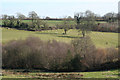
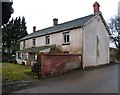
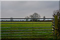


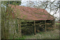
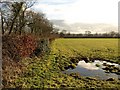
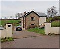
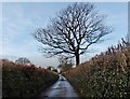
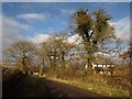
10 photos from this area
Area Information
Key information about the EX15 3TW including its size, population, and administrative classification.
- Area Type
- Postcode
- Area Size
- 89.4 hectares
- Population
- 2006
- Population Density
- 71 people/km²
House Prices in EX15 3TW
10
Properties
£698,750
Average Sold Price
£365,000
Lowest Price
£950,000
Highest Price
Showing 10 properties
| Address | Type | Beds | Baths | Last Sale Price | Last Sale Date | |
|---|---|---|---|---|---|---|
| Lavender House, Road Past Higher Hill Farm, Clayhidon, EX15 3TW | house | - | - | £945,000 | Oct 2020 | |
| Tredown Farm, Road Past Higher Hill Farm, Clayhidon, EX15 3TW | Bungalow | 4 | 2 | £535,000 | Oct 2019 | |
| Hunters Lodge Farm, Ford Street, Wellington Without, Wellington, EX15 3TW | house | - | - | £950,000 | Dec 2018 | |
| Chatter Close, Road Past Higher Hill Farm, Clayhidon, EX15 3TW | house | - | - | £365,000 | May 2009 | |
| Acre Ridge, Ford Street, Wellington Without, Wellington, EX15 3TW | Detached | 4 | - | - | - | |
| Acre Ridge Cottage, Ford Street, Wellington Without, Wellington, EX15 3TW | Bungalow | - | - | - | - | |
| Ladysmead, Road Past Higher Hill Farm, Clayhidon, EX15 3TW | Bungalow | - | - | - | - | |
| Higher Hill Farm, Road Past Higher Hill Farm, Clayhidon, EX15 3TW | Detached | - | - | - | - | |
| Fenix Carriages & Driving Centre, Fenix Carriages, Road Past Higher Hill Farm, Clayhidon, EX15 3TW | Office | - | - | - | - | |
| Land At Grid Reference 316579 116796, Road Past Higher Hill Farm, Clayhidon, EX15 3TW | Leisure | - | - | - | - |
Energy Efficiency in EX15 3TW
Amenities
Schools
| Rank | School | Type | Entry gender | Ages |
|---|
Explore more schools in this area
Go to Schools tabDemographics
Household Size
Two person
most common
Accommodation Type
Houses
most common
Tenure
71
majority
Ethnic Group
White
most common
Religion
N/A
most common
Household Composition
N/A
most common
Age
47
median
Adults (30-64 years)
most common
Household Deprivation
N/A
with no deprivation
NS-SEC
36
in Lower managerial occupations
Explore more demographic insights in this area
Go to Demographics tabPlanning
Planning Constraints
- Flood RiskPremium
- Ramsar Wetland SitesPremium
- Area of Outstanding Natural BeautyPremium
- Protected Nature ReservePremium
- Protected WoodlandPremium