Area Overview for TA21 9LJ
Photos of TA21 9LJ

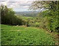
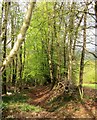


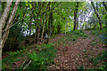

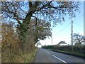

11 photos from this area
Area Information
Key information about the TA21 9LJ including its size, population, and administrative classification.
- Area Type
- Postcode
- Area Size
- 1.7 km²
- Population
- 2180
- Population Density
- 61 people/km²
House Prices in TA21 9LJ
18
Properties
£434,400
Average Sold Price
£270,000
Lowest Price
£615,000
Highest Price
Showing 18 properties
| Address | Type | Beds | Baths | Last Sale Price | Last Sale Date | |
|---|---|---|---|---|---|---|
| The Forge, West Buckland Road, West Buckland, Wellington, TA21 9LJ | Detached | 3 | - | £615,000 | Aug 2025 | |
| Mole Hill, West Buckland Road, West Buckland, Wellington, TA21 9LJ | Detached | 4 | 2 | £482,000 | Mar 2015 | |
| Rose Cottage, West Buckland Road, West Buckland, Wellington, TA21 9LJ | Detached | 4 | - | £455,000 | Mar 2014 | |
| Orchard Croft, Bussells Farm Lane, West Buckland, Wellington, TA21 9LJ | Detached | - | - | £350,000 | Feb 2006 | |
| Westfield, West Buckland Road, West Buckland, Wellington, TA21 9LJ | Detached | - | - | £270,000 | Jul 1996 | |
| Trees Farm, West Buckland Road, West Buckland, Wellington, TA21 9LJ | Land | 4 | 3 | - | - | |
| Crosses Farm, Bussells Farm Lane, West Buckland, Wellington, TA21 9LJ | Detached | 4 | - | - | - | |
| Alebar Farm, Bussells Farm Lane, West Buckland, Wellington, TA21 9LJ | Land | - | - | - | - | |
| Hillside, West Buckland Road, West Buckland, Wellington, TA21 9LJ | Detached | - | - | - | - | |
| Birdcage Cottage, Gerbestone Road, West Buckland, Wellington, TA21 9LJ | Detached | - | - | - | - |
Page 1 of 2
Energy Efficiency in TA21 9LJ
Amenities
Schools
| Rank | School | Type | Entry gender | Ages |
|---|
Explore more schools in this area
Go to Schools tabDemographics
Household Size
Two person
most common
Accommodation Type
Houses
most common
Tenure
83
majority
Ethnic Group
White
most common
Religion
N/A
most common
Household Composition
N/A
most common
Age
47
median
Adults (30-64 years)
most common
Household Deprivation
N/A
with no deprivation
NS-SEC
38
in Lower managerial occupations
Explore more demographic insights in this area
Go to Demographics tabPlanning
Planning Constraints
- Flood RiskPremium
- Ramsar Wetland SitesPremium
- Area of Outstanding Natural BeautyPremium
- Protected Nature ReservePremium
- Protected WoodlandPremium